I carry a GPS unit with me whenever I ski and and Whistler was no exception. I usually take the GPX files and map them with Nat Geo’s TOPO program, but I don’t have the map data for British Columbia. I stumbled across a very nice web app called uTrack. You upload your GPX file, wait a few seconds, and then you’re left with a ton of stats and a map that you can view with Google Earth.
So how did we do? A normal ski day for me is something between 15,000 and 20,000 vertical feet. Not only did we surpass 30,000 feet each day, but we unknowingly skied almost exactly the same amount each day. Over the three days we skied 93,800 vertical feet and covered 156 miles! (The mileage number includes the lifts.) We averaged 15mph on our downhill runs, and Jay topped 50mph at one point!
Each day we rode the Peak 2 Peak gondola. We skied one mountain in the morning, rode the gondola over after lunch, and spent the remainder of the day on the other mountain. I don’t think we ever planned that but it was nice to have the option and it’s an amazing ride. If you’ve never heard of that gondola, check out some of the world record stats.
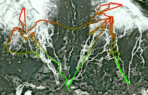
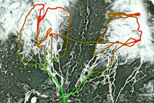
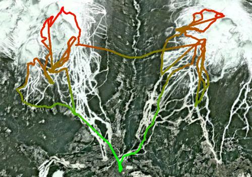
And finally, here are some 3D maps of our ski route each day. Red indicates high elevation and green is the lower elevations. Whistler is on the right and Blackcomb is on the left.