Studio711.com – Ben Martens

hike

Rattlesnake Ledge

Logan invited us along on a hike and we ended up at Rattlesnake Ledge. I’ve done the hike a few times before but it was the first time for Logan, Tyla and Elijah. The hike provides a great payout for a moderate amount of effort which means that it is usually very crowded and that day was no exception.

I carried Elijah in the pack all the way up and most of the way down. He was happy to walk part of it, but it was really slow going since we had to stop to get passed both by people heading the opposite way but also by people who were going the same way as us. So he just bopped along (heavily) in my backpack.

It really is a beautiful hike and the consistent climb up to the top is nice versus a hike that alternates between flat and steep sections. The crowds get to me after a while though. I prefer the hikes where you only see a couple other people but there are reasons why those trails are more sparsely populated. I’ll have to get used to these easier busier trails for a while as Elijah learns to hike on his own.

rattlesnake1 rattlesnake2 rattlesnake3 rattlesnake4

Fremont Lookout Hike

Today is my birthday and when Tyla asked what I wanted to do for my birthday weekend, I requested a hike. I had hoped to do a lot more hiking this summer but it hasn’t happened yet. So on Saturday we packed up the car and headed to Mt. Rainier.

I chose the hike out to Fremont Lookout. It’s one I’ve done twice before but it’s a great one. It’s something like 6 miles round trip with about 800 feet of elevation gain. It’s not super strenuous but the trail does get narrow and requires your concentration to avoid a long slide to your doom.

The weather was gorgeous and the temperature was perfect for hiking. Unfortunately it was a little windy at times and Elijah was just along for the ride so he was pretty cool. Thankfully Tyla had planned well and we had enough extra gear to keep him warm. Elijah walked about 1 of the 6 miles and happily rode in the backpack for the rest of the way. I was happy to survive the hike with the ~40 pound pack.

It’s a little over 2 hours away from our house so it’s quite a hike (pun intended) but it’s so cool to have world class hikes like this within range of an easy day trip!

Thanks to Tyla for taking a bunch of great pictures along the way too! Oddly enough, neither Tyla nor I took any pictures of the actual lookout, but you can find plenty of those on the interwebz.

rainier2016_1 rainier2016_2 rainier2016_3 rainier2016_4 rainier2016_5

Tolt MacDonald Camping

Tyla and I used to go camping once or twice a summer before Elijah came along. Then we got a little gunshy about camping with a munchkin. We have visited Tyla’s family at a campsite multiple times but we’ve never slept at one overnight. It was time to try it out for real.

I picked Tolt MacDonald park as a location that wasn’t too far away but one that still has some interesting stuff for us to explore. It’s the same park where we had our family photos taken. I know there are lots of you who would have been happy to come along, but we wanted to do this first trip by ourselves to make some family memories and then be ready for bigger trips with more people.

We had great weather for the trip and Elijah loved it! We all went to bed together at night around the time the sun set and he was zonked so he fell asleep quickly. We spent Saturday down by the river playing the sand and we also drove over to Snoqualmie Falls. I haven’t been there since they redid the lower viewing area. They have it completely blocked off so that it’s impossible to get down to the rocks below the falls. I’m glad we had opportunities to explore there years ago before access was shut off.

Elijah got to roast his first marshmallows over a real campfire and eat meals outside. He loved it all and didn’t want to go home at the end. The only misstep we had was that he woke up at 6am on the last day and couldn’t get back to sleep. He hasn’t figured out how to keep quiet for very long so we went on a 2 mile hike through the woods to avoid waking up everyone else. All in all, the trip was a success though.

Personally, I was thrilled to go camping with the truck. It was so easy to toss everything in the back. And this was the first time we had fully set up our new tent. That tent is going to last us forever. It’s built really well and worked great. Unfortunately the same can’t be said for my air mattress. I vaguely remember a leak from the last time I used it years ago but for some reason it didn’t get thrown away. So I spent the second half of both nights laying on the ground. I remembered to toss it in the trash this time.

It was a really nice weekend and I’m excited that we can start adding these trips back into our summer schedules again.

toltmacdonaldcamping_1 toltmacdonaldcamping_2 toltmacdonaldcamping_3 toltmacdonaldcamping_4

Talus Rocks Hike

All this nice weather had me itching to get out for a hike so Saturday morning we piled in the car and headed for Tiger Mountain. Instead of attempting the peak with a ~25 pound kid in a backpack, we did the Talus Rocks trail (#8 from Beyond Mt Si).

Elijah did a fantastic job on the trip. He rode calmly in the backpack the whole time and talked nonstop. The most common topic was about which trees had fallen down and which ones were “good strong trees.” I think he’s slightly nervous because we’ve seen some trees falling (even on a car) so this was his way of working through it.

We made pretty good time on the hike with only one quick stop to shed some layers. The trail from the main West Tiger 3 trail over to the Nook Trail was pretty much covered in trees and we bushwacked a bit around some closed areas. Eventually the deer path or whatever we were following ended up back on the main trail and we continued along. The nice thing about Tiger Mountain is that as long as you understand the basic layout of the main trails or if you have a map handy on your phone, it’s pretty hard to get lost because there are so many well-travelled and well-marked trails.

We covered 3.3 miles and averaged 2.4 mph. Hopefully this was just the first of many hikes for the season!
talusrocks1

talusrocks2

talusrocks3

Greenwater Lakes

After the success of our Barclay Lake hike, we decided to try it again. We met Mandy and Ike at their house, got both car seats into one car and piled in for a 1 hour 45 minute drive down to the trailhead for Greenwater Lakes. It’s off of Hwy 410 on Forest Road 70. The drive was a little long for the boys both coming and going, but it’s nice to get a little farther away from the popular, crowded trails.

The hike had a little more vertical than the Barclay Lake hike but it wasn’t too bad. Unfortunately the lakes at the end weren’t as great as we were expecting. They both looked really low which is unusual for this time of year but probably expected given the low snowpack. We had a normal amount of precipitation during the winter, but it wasn’t in the form of snow so it wasn’t released slowly down the mountain during the spring melt.

We ended up going all the way past the bigger, second lake and found a nice spot along the river that feeds into the lakes. The boys had fun throwing rocks into the water while we enjoyed a picnic and rested up for the trip back.

I don’t think we’ll do this one again, or at least if we do, we’ll wait until we know the lakes are fuller. There were some reasonably good camping sites available in that area too.

greenwaterlakes1 greenwaterlakes2 greenwaterlakes3

Barclay Lake

We’ve had an incredible spring in terms of weather. Normally we are in the midst of “June gloom” where it might not be super wet, but it’s 100% cloudy for weeks on end. Instead, we’re in a stretch of warm weather and clear blue skies. We don’t usually get this until July. I’ll take it!

When you get nice weather in the Pacific Northwest, you better take advantage of it, and that’s just what we did. We loaded up the car and headed to Barclay Lake for a hike with Nancy, Megan, Mandy and Ike. Our previous attempts at hiking haven’t been super successful because Elijah ends up getting tired of riding in the backpack and wants to walk. Walking turns into a game of endless distractions that doesn’t result in us moving down the trail.

This hike went a lot better, and it might be because Ike and Elijah could both see the other one riding in a backpack. The hike was not too difficult, but it ended at a very nice lake. Elijah and Ike spent their time throwing rocks and mud into the lake while the rest of us had a picnic.

Ike and Elijah both fell asleep in the backpacks on the way back to the car and the hike was a success! The only downfall was that I had underestimated the traffic that would be coming back through the pass on Memorial Day. It added about 90 minutes to our 90 minute drive. Ouch.

Two thumbs up for Barclay Lake though. There were a lot of very nice potential camping spots around the lake and I could see it being a good spot for a first overnight trip with Elijah when he’s older and able to carry his own pack.

barclaylake1  barclaylake2 barclaylake3

Lopez Island

While Dad and Mom were visiting, we spent a couple nights in a rental house out on Lopez Island. It was the first time any of us had been there and I really enjoyed it. It’s one of the smaller islands, and while none of the islands are “busy”, this one was very quiet/local. Highlights included some nice, quiet beaches and a short hike out to a rocky bluff where we could watch a LOT of seals. Our best meal was at Southend General Store and Restaurant. It’s not a place you would drive by and expect to have good food, but I think we would all be happy to eat there again.

I took a bunch of Photosynths. There’s the view from the deck, the park with the seals, and one showing the inside of the house.

Thanks to Dad and Mom for renting the house and letting us crash the party!

Anti-Aircraft Peak

We purchased a used hiking backpack earlier this year, but aside from walks around the neighborhood and working in the yard, we’ve never really used it. Now that the yard is finally done, we are able to spend more time together as a family so this past weekend, we headed out on a more legitimate hike.

Since we didn’t know how Elijah would react to the adventure, I picked a hike that I’ve been avoiding throughout the years because of it’s simplicity. Simple is good in this case though. So we headed for Cougar Mountain to hike around the Anti-Aircraft Peak area (hike #3 in the Beyond Mt. Si book.)

This area was the site of some post-WW2 90mm anti-aircraft guns to help guard the Puget Sound Area. They were later replaced with a site for the Nike Ajax Missile Defense. None of that stuff is still operational or even present on the mountain anymore.

The hike itself went pretty well. We made it about 1.4 miles before Elijah decided he wasn’t loving it. We stopped for a break, but given how unhappy he was when he got back in the pack, we decided to take one of the shorter options to finish the hike at around 2.2 miles. He was almost falling asleep at the very end so we probably could have completed the entire planned hike.

I’d call it mostly a success though. I want to make a few modifications to the backpack to help hold him in place better. I also need to avoid wearing a hat with a big long string that he can pull on! Assuming that he gets more used to riding back there, I think we could tackle some slightly longer trips.

Hiking Crystal Mountain

My parents were out over Labor Day for their annual visit. I’ll have a couple posts about our activities from the weekend, and this first one is about our trip to Crystal Mountain. I don’t get down there in the summer very often since we usually drive past and head to Rainier.

After a delicious breakfast at the Brown Bag Café in Kirkland, we headed to the mountain and purchased tickets for a gondola ride. The ride up was beautiful and the skies were perfectly blue. Mt. Rainier was there in all it’s glory. We paused at the top for a while to marvel in the view and for me to attempt another panorama. I attempted this one at maximum zoom which is more difficult, and it didn’t come out very well. There were quite a few gaps where I didn’t overlap the pictures properly. You can view it on the Photosynth site. While the overall image isn’t that great, it is pretty neat to see how far you can zoom in. I also added a marker (look on the right side of the page for the link) to the Mount Freemont Fire Lookout. I hiked there with my parents years ago and earlier this year with Tyla.

We decided to hike our way down heading around the backside of the gondola, under Powder Bowl, across Bear Pits, under the Forest Queen lift, along the southback border, and then over to Gold Hills and down to the base. Its somewhere between 5 and 6 miles and 2400 feet down. It’s a wonderful hike that shows a lot of different parts of Crystal. You start off with great views of the mountain, then go along some steep open hillsides, pass by a lake, and then walk through an old growth forest complete with an old gold mine.

As we were nearing the end of our hike, I spotted a couple up ahead that looked familiar. It was my cousin Jared and his wife Gayla. They live over in Moses Lake! We had no idea they were going to be at Crystal and the odds of bumping into them in such a huge area are astronomical. They were staying the night and having dinner at the Summit House. They must have had a wonderful view with the sun setting behind Rainier while they ate!

Kudos to Mom who did this all on a healing broken toe! Photos are posted in the photo gallery.

Climbing Mt. St. Helens

Mt. St. Helens is an amazing National Park. The volcano blew in 1980 and experts thought it would be a complete dead zone for 400 years. Within 3 years, life started reappearing in the desolation. Science has rarely had an opportunity to study a spot like this up close. So it’s understandable that they don’t allow very many people on the mountain! Nobody can go inside the crater or along the north side of it where most of the devastation was. You are allowed to climb up the south side, but you need a permit and during most of the year (except the dead of winter) only 100 people are allowed to climb per day.

Last year, AndyD and StehanieW climbed it with their family, but since you have to pick your climbing day months in advance, they got unlucky and climbed in complete fog. They wanted to do it again to see the sights so on Feb 1, Andy snagged some climbing passes.

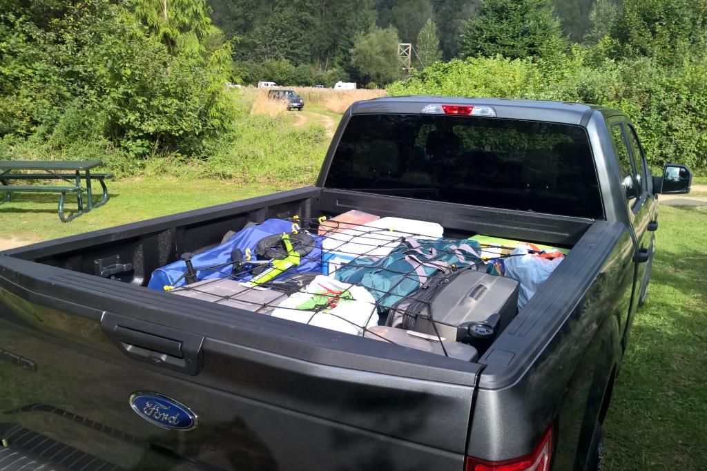
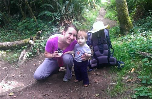
The climbing group was to include myself, Tim, Chelsea, Andy and Stephanie. Tyla really wanted to come along, but her knees don’t do well on long hikes so she reluctantly abstained. A couple days before we were to head out, Andy and Stephanie had to back out for personal reasons. Tim, Chelsea and I decided to carry on so on Saturday afternoon we headed around to the south side of the mountain. The plan was to stay in a campground the night before so that we could get an early start. Our campground was in Cougar, WA which is about 20 minutes from the trailhead. There are also free campsites (if you have the climbing pass) right at the trailhead but those are first come first serve.

We arrived at the trailhead on Sunday morning around 7:30am and by 8am we were on the trail. This trailhead is called Climber’s Bivouac. At 3900 feet, it’s the highest point that you can drive on Mt. St. Helens. If you’ve driven to the mountain before, you most likely drove to the Johnston Ridge Visitor’s Center that is north of the mountain. There’s also one other smaller Visitor’s Center on the east side. Neither are as high as this trailhead.

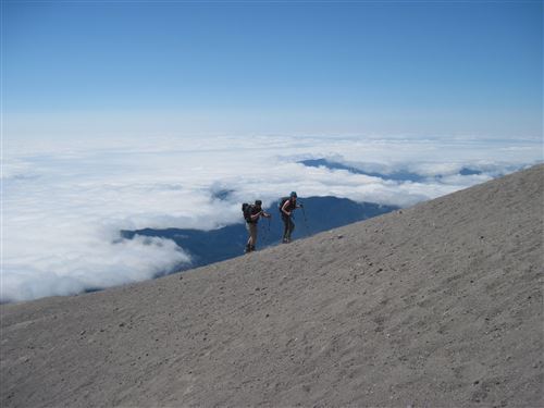
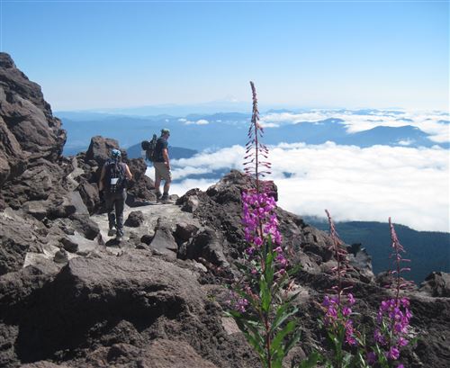
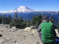
The route begins with a 2 mile stroll through the woods. It goes up about 1000 feet. This part flew by on the way up as we were fresh and the trail was simple. At 2 miles, you abruptly come to the end of the tree line and reach a sign saying that you must have one of the climbing passes to carry on past that location. No one is allowed above 4900’ on the mountain without a pass. We had broken out of the clouds a during the hike through the woods and as we continued, we were in blue clear sky with a blanket of clouds below. We could see Mt. Adams and Mt. Hood sticking proudly out of the cloud layer. Quite a sight!

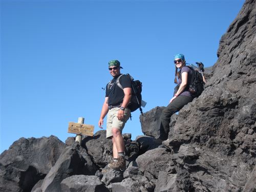
At this point, the trail completely changes character and head up an old lava flow (from an eruption before the 1980 eruption.) This stretch lasts about 1.5 miles and it’s tough. The rocks will rip up your hands so gloves are recommended. There are many points where you have to climb up on all fours. Climbing over these huge boulders is tough to begin with, but to make it even worse, there’s no specific path to follow. There are route markers every couple hundred yards and you just have to make your way to the next one. Sometimes you can see a good route to take and sometimes we seemed to end up taking the hardest possible route.

The lava flow boulders end eventually and now it’s on to the ash! The last mile is a slog up an ash field. For every step up, you slide have a step back. And by this point, you’re really getting up there so the oxygen is a lot thinner than you are used to. This is the point where the wind can also be whipping the ash around so general advice is to make sure you can cover every part of your skin (long sleeves, long pants, and a bandana for your face.) Thankfully the wind was calm so we stuck with gaiters to keep ash out of our shoes and our hiking poles to give us extra stability.

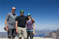
We made it to the top of the mountain (8366 feet above sea level) in 4 hours and 40 minutes. We did get passed by about a dozen people, but looking through other trip reports, this is a respectable amount of time. We said from the beginning that our goal was the top, not the amount of time it took so we took plenty of breaks for photos and rests.

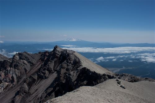
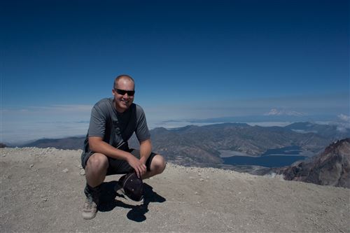
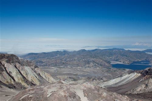
You can walk all the way up to the crater rim and wow, what a view! It’s so unlike anything I’ve ever seen before (and I’ve been to the visitor’s center many times.) The sheer magnitude of it is readily apparent. We stayed up there for about 30 minutes taking in the views of Rainier, Adams and Hood in the distance and watching steam escape from vents in the lava dome in the center of the crater. I hastily snapped a bunch of photos for a panorama. There are a few problems from where it was stitched together and I should have taken more photos, but I had to stand uncomfortably close to the rim and the wind was blowing pretty hard trying to push me in.

As we began our descent, the ash field was pretty simple. You could keep a good pace with a controlled slide on the heels of your feet, and before no time, we were back at the lava fields. Ugh. Going down was harder than going up. We were only about half way through when I could tell my legs were shot. Your calves take a beating going up and the thighs take the brunt going down.

After what seemed like ages, we made it to the tree line. The smooth trail was glorious, but even the gentle downhill slope was super painful on the thighs and knees. Tim and Chelsea definitely set the pace for this part of the hike as I lagged behind. At one point near the end, I had stopped to get something out of my pack and thought I was standing next to a pile of poo. I realized it was my own B.O. The trees seemed to last twice as long as they did on the way up, but we made it to the parking lot, thoroughly beaten and completely covered in ash and sweat.

One big decision on a hike like this is how much water to take. If you’ve ever run out before (as Tim and I have), you want to err on the side of bringing too much. But every liter weighs 2.25 pounds and you don’t want to be carrying any more weight than necessary. I took a 3 liter Camelbak full of water and a 2 liter one full of Gatorade. The Gatorade ran out right at the crater rim and I finished the hike with 1/4 liter left. Perfect!

It took us 3 hours and 20 minutes to get down which means we were hiking for 8 hours plus 30 minutes at the top. Even though we were so tired, the lure of our beds was strong. We went back to the campground, took showers, and packed up the campsite while we were cooking food on the fire. After eating a delicious meal (anything would have tasted good at that point!) we hopped in the truck and headed home.

It was a long day and I don’t know that any of us are jumping to do it again soon, but we’re all thrilled that we did it!

I owe a special thanks to my wonderful wife who was supportive of me going even though she was staying behind. Thank you Tyla! I love you!

Chelsea and I both carried our little cameras up which were easily accessible during the hike. TIm and I both carried our dSLRs to the top, but his was much easier to get to than mine. We took quite a few photos but it’s really hard to show the scale of the hike in these photos! Nonetheless, I’ve included some of my favorites in this post and put more in the photos gallery. You can also view a big panorama from the top of the mountain. Drag your mouse around and zoom in and out to get the full effect. Also notice the thumbnails on the right side of the panorama. If you click on them the page will reorient and zoom in to points that I’ve marked on the photo.


View the full panorama
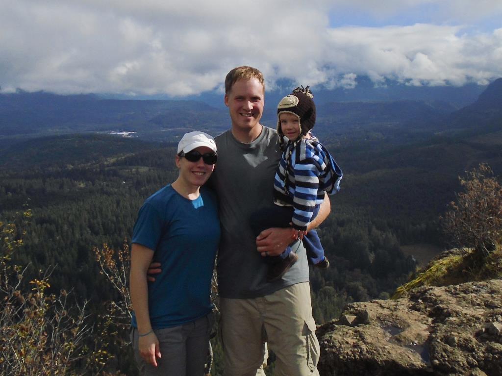
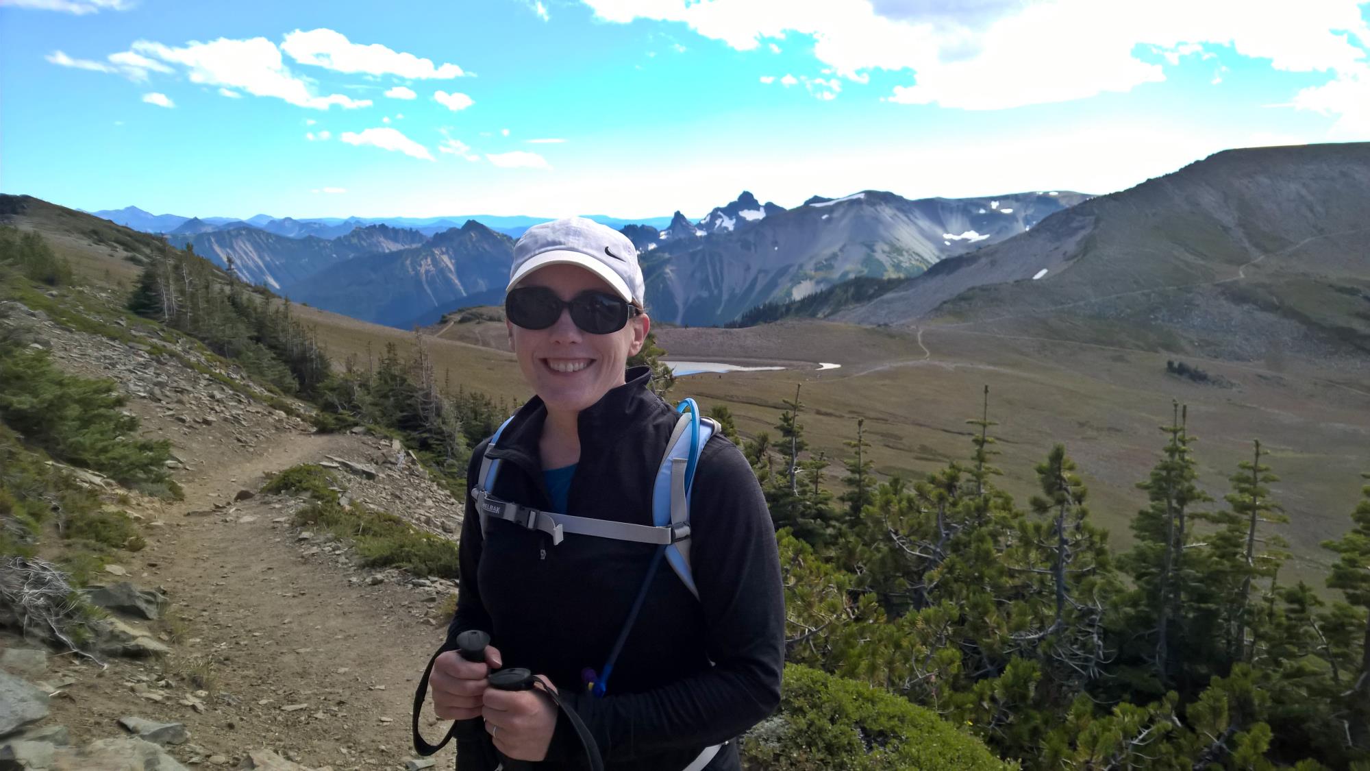
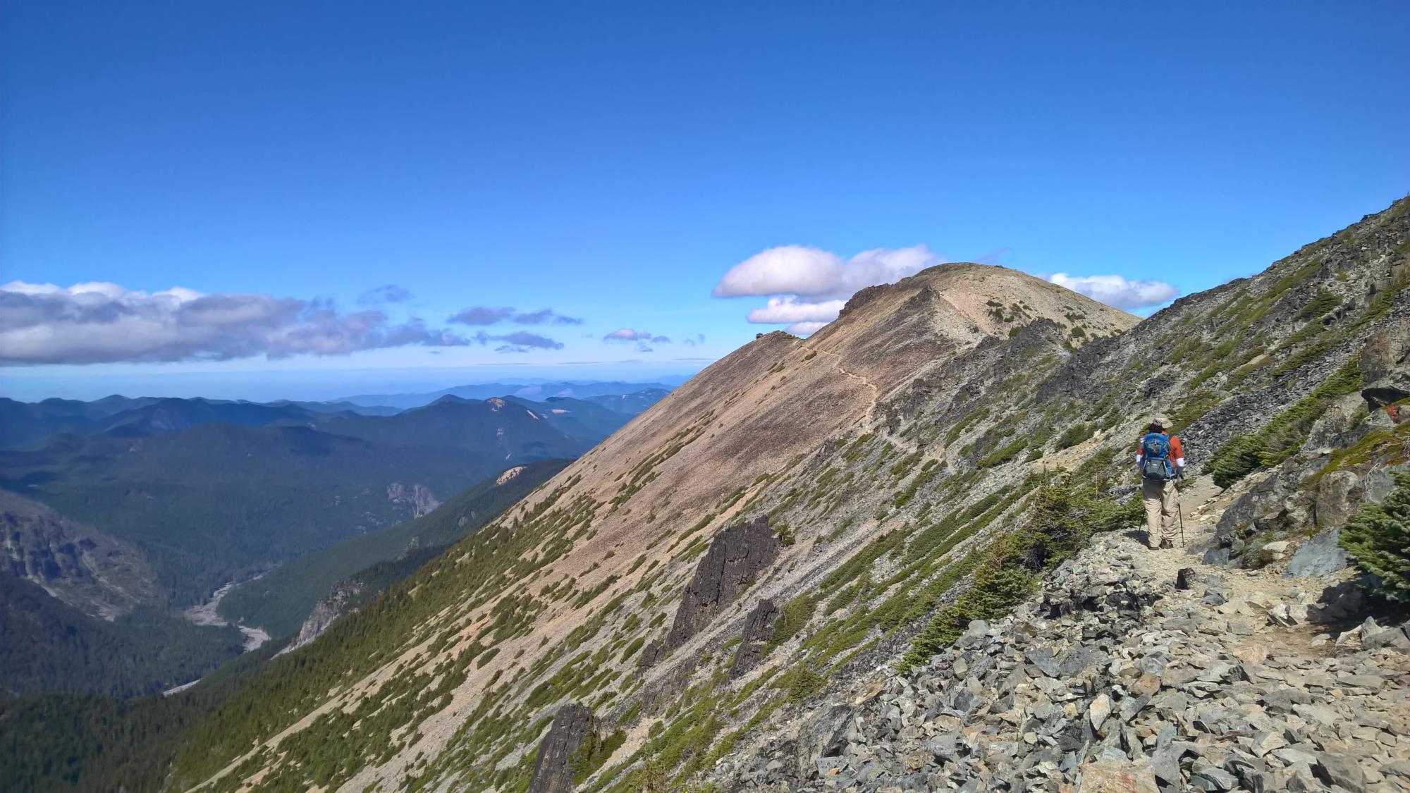
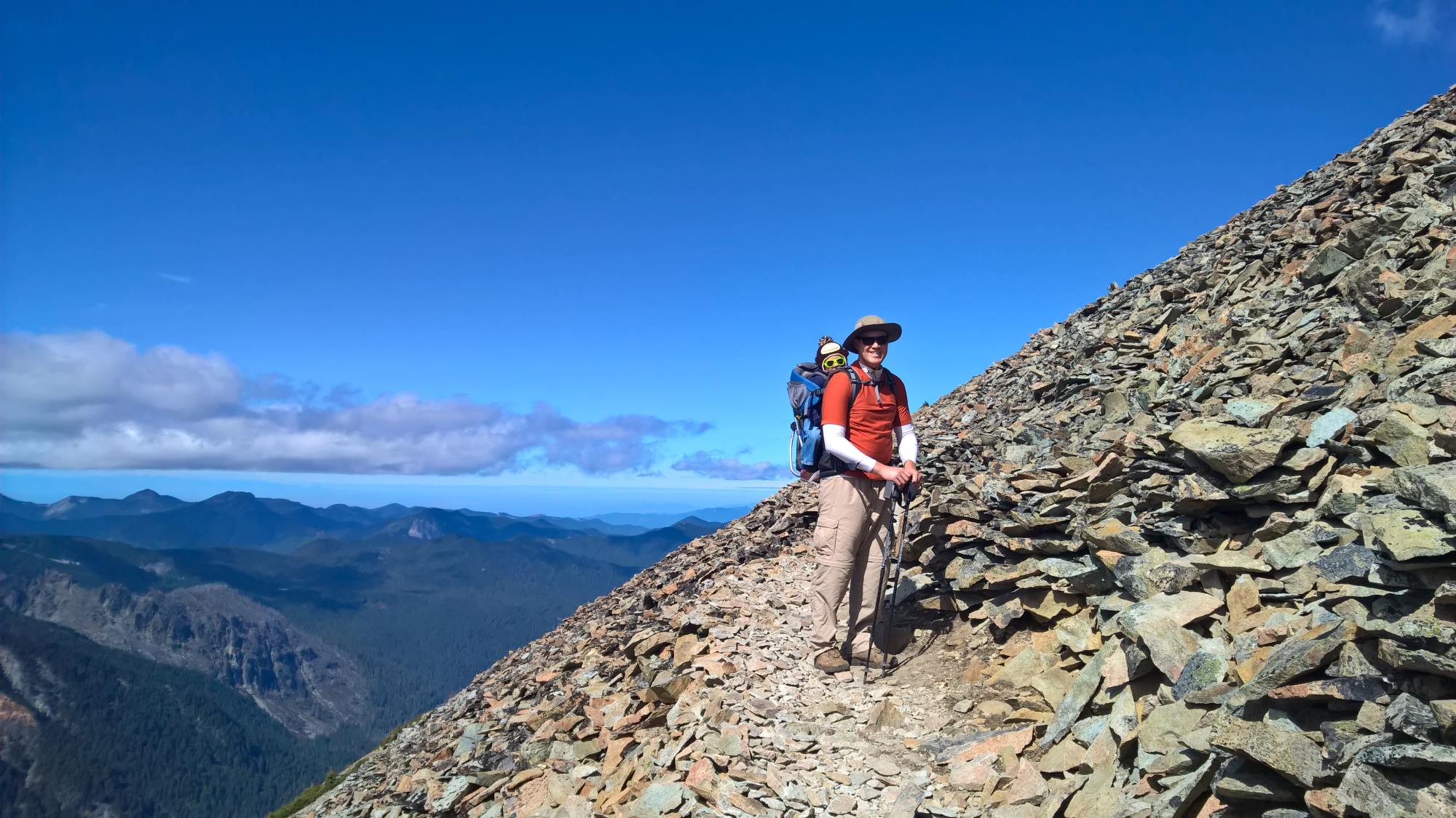
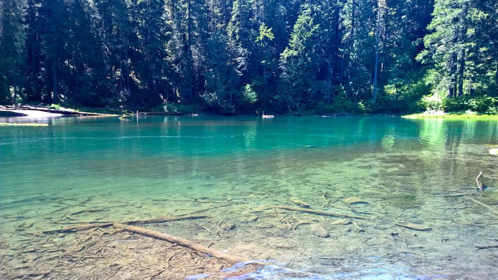
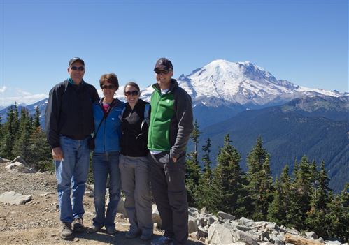
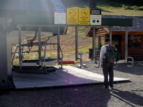