Studio711.com – Ben Martens

CrashPlan Service Changes

I’ve been an enthusiastic CrashPlan cloud backup user for well over 6 years. The small fee that I paid for their service saved me a ton of time trying to hack together my own solution. Unfortunately, yesterday I got an email saying that they are going to stop offering CrashPlan Home and focus on the business market. The transition plan sounds very smooth and they’ll continue honoring all of the time that I’ve prepaid for, but of course it means that I need to start thinking about what to do when my service runs out in a little over a year.

There are a few options to consider:

  1. CrashPlan is officially recommending Carbonite (who was a competitor until CrashPlan exited the home market). Their service is $60/year which is very similar to CrashPlan. The only downside is that I have to re-upload my ~4TB of data. That’s not horrible except that Comcast silently added a 1TB/month cap to my plan.
  2. Stick with CrashPlan and use their Small Business offering. While they are offering existing users a nice discount for the first 12 months, eventually it will cost me $120/year. It’s roughly double what I was paying, but maybe it’s still worth it since I don’t have to change anything.
  3. Go back to rolling my own solution. It’s not too hard to encrypt the data myself and then upload it to Azure blob storage. This would be kind of fun to piece together but it’s not going to be cheaper than Carbonite or Crash Plan Small Business. They set their prices for the amount of data a normal human uses and clearly I’m not that.

Thankfully I don’t have to make this decision any time soon. My contract runs through Oct 2018. However, if you’re thinking about starting to use cloud backup (and I recommend it!), you should be looking at providers like Carbonite or Mozy.

Mason Lake and Little Bandera Mountain

Saturday is our first attempt at Camp Muir (depending on the weather) so Logan and I wanted to squeeze in one more hike. We went for Mason Lake because it wasn’t too far away and it was relatively easy. The trail climbs up to the top of a ridge and then drops down a couple hundred feet to the lake. We were almost the first ones to the lake again (another guy beat us by a couple minutes) and we got to enjoy it in peace before the crowds came up behind us. We made it there very quickly with only one stop to remove our pant legs and convert to shorts. Since we were still feeling fresh and it was only 8:30am, we decided to take another fork of the trail and go up to the top of Little Bandera Mountain.

Whew. It was STEEP.

My GPS watch has been pretty accurate on our hikes and it reported 980 vertical feet over 0.6 miles. The trail isn’t traveled very much and after just a little bit, the trail builders obviously gave up on the switchbacks and just went straight up the hill. It was a slog but we made it scrambling up on all fours. I included a chart from our trip in the photos below. You can see the hike up to the peak and notice how much slower we went on that part with frequent stops. The third picture was also take on that steep slope but it’s always hard to see slope in a photo. Just note how close Logan is but yet how much lower he is! You can click on any of the pictures for a bigger view.

The view at the top is supposed to be incredible with Mt. Rainier standing proudly for you to enjoy. Unfortunately there were a lot of clouds to the south, but the view to the north was great. We looked down on Mason Lake where we had been earlier that morning.

All in all it was a great hike and hopefully we’ll be ready for Camp Muir on Saturday!


Wood Sign

Router-carved signs are a common sight at fairs or even in pop up shops at the mall. I’ve been watching a bunch of Dave Rhoten’s videos on YouTube and finally I decided it was time to try it for myself. I purchased a Dewalt DWP611 along with two special router bits and a nice base plate from Dave’s store.

I bought 1×8 select pine from Home Depot (mostly knot free) and put on a couple coats of shellac. Then I used the laser cutter at work to draw the letters that I wanted to cut. That made the layout portion of the project very easy!

The next step was the most time consuming. I used a very narrow V-bit to carefully cut around the outside of every letter. Then I put in a bigger 90 degree V-bit to draw the big cloud around the outside and cut out everything between the cloud edge and the edge of the letters.

After a little cleanup with some chisels to remove any remaining high spots, I covered the whole piece in black spray paint. When it was dry, I sanded the top which removed the paint from the letters and the part outside the cloud leaving the indented part black. The shellac coating helped to keep the paint from bleeding too deep into the wood on the parts where I didn’t want it to stick.

Finally I used my keyhole bit to cut a slot in the back for a screw or nail so it could be easily hung on the wall.

This was a gift for Don’s brother and his wife in Montana as a thank you for letting us stay with them. And since I was making one, I decided to make two and give one to Don as well. It’s a fun and relatively quick project, but it takes patience!

Best Of YouTube

It’s been a while since I’ve done a Best Of YouTube post, but, as usual, a lot of great content has been flowing into my eyeballs. First up this time is from the Flite Test guys. They are doing some full scale flight content in addition to their normal RC content. They went to Oshkosh for the big airshow and posted a good wrap-up video. Fun fact: They talk a lot about Sean Tucker in the beginning. He was the only signed photo I had in my room for much of my childhood.

If you pay attention to video shot with your cell phone or most other consumer cameras, you may have noticed a jello effect where straight lines of things moving quickly through the frame aren’t straight. It’s caused by something called “rolling shutter.” Whether you already know about that or not, this video is still incredible. The special effects do a fantastic job at explaining the subject matter.

Modern Rogue is pumping out good content. Some of it is a bit too long for my tastes, but overall, I’m excited when they put out a new video. They’ve had a couple martial arts/self-defense videos. The latest one is about choking someone quickly. While you’d need to practice to get good at it, it’s not super complicated and it seems pretty easy to remember.

Lake Melakwa

Our hike up to Camp Muir is getting drawing near. Logan and I have been doing quite a few hikes this summer to prepare and last Saturday it was Lake Melakwa. We had originally planned to attempt to get to Mailbox Peak (one of the hardest local hikes) but given the smoke, we decided to do something that didn’t require clear skies for the payoff at the top.

It’s a good thing we switched to Lake Melakwa. Even though the smoke had started to blow out of the area, there were a lot of clouds and even a few raindrops on our windshield as we drove there. (We haven’t had rain in 56 days!) Mailbox Peak almost certainly would have had a disappointing view at the top.

We left my house at 6am, hoping to get to the trailhead before this incredibly popular hike got super crowded. The early start paid off. We hit the trail at about 7:10 and we were the first ones up it. That meant we got to clean out the spider webs but it also meant that we didn’t see a soul until we got to the lake!

The hike was gorgeous. I can see why it is so popular. You cross Denny Creek a few times both with bridges and without. You walk under the enormously tall I-90 raised roadway and there is a fairly tall waterfall. Even if you just went a mile up the trail to “waterslide rock” to let your kid play in the water, I’d still say it’s a worthwhile hike.

It’s around 9 miles roundtrip with 2500 feet of elevation gain. On the way up, I felt like the trail was relatively smooth, but on the way down I really noticed all the rocks on the upper part of the hike. It’s not nearly as rocky as a hike like Pilchuck though. And while Melakwa is the Chinook word for mosquito, we only saw a handful of bugs. There was a pretty constant light rain at times on the hike so maybe that kept them at bay.

The views on the way up were great but wow, that lake is gorgeous! We made it up in just a shade over 2 hours. We were the only ones there except for a couple overnight campers across the lake. A few groups were only 5-10 minutes behind us though.

I don’t know exactly what my top 3 hikes in the area are, but this is probably one of them. The only catch is that you really should get there by 7 or 7:30. When we left there were an incredible amount of cars there and hiking is so much better when you have some solitude! Not to mention that it’s better when you can park right by the trailhead instead of adding a mile to the hike so you can get to your car.

You can view our trip stats on the Garmin site. It’s a little screwed up because I forgot to stop it until about 10 minutes down the road.

Sunburns

The Stuff You Should Know podcast is full of awesome trivia, but one of their recent episodes taught me a lot about a subject I thought I already knew well. The title is “Sunburn, Suntans and Sunscreen“. Throughout the episode they busted a bunch of myths that I thought were facts and explained the science behind sunscreen. I’m especially interested in the topic given the three chunks of skin that I’ve had cut out of me. If you only listen to one episode of that show, this is a good one to listen to! You don’t have to do anything fancy to subscribe if you don’t want to. Just go to that link and click play.

And if you like that one, check out another one of my recent favorites: How Ketchup Works.

Fort Peck Dam

I didn’t know a lot about Fort Peck, MT before I visited, but it’s a really interesting place. The town started as a trading post along the Missouri River. In 1934, The Army Corps of Engineers rolled in and built a new town about 2 miles from the original town to house all the workers for the big dam project. A number of shanty towns grew up around the area too to house the ~10,000 workers. Some of those buildings are still around, including the hotel where we had brunch on Sunday.

The dam is a monstrosity and it’s incredible to think about workers in the 30s, 40s and 50s building something that enormous. The dam itself is made up of rock and earth. It’s a shade under 4 miles long and 250 feet tall. The coast line of the reservoir is longer than the coast line of California. The reservoir is the 5th largest man made lake (by volume) in the United States.

To get enough dirt for the project, they dredged a bunch of dirt and pumped it to the dam. We went swimming in one of those dredge cut lakes while we were there. They had to modify their design in flight because part of the dam slid while they were building it.

PBS has a great video about the building of the dam. Unfortunately we can’t watch it online here, but it’s a regional thing so maybe it will work for you. Even if it doesn’t work, you should be able to watch a ~3 minute preview.

In the picture below, you can see the road that runs along the top of the dam. To the right there is a park by smaller lake below the dam and that’s where we had the family reunion. Up on the hill on the right side of the picture is the town of Fort Peck. I hope that we’ll get to go back and visit again some day!

Happy Birthday Tyla!

Happy birthday Tyla! On Saturday she chose to spend some time down by the river in Monroe, Sunday afternoon was spent eating fried chicken with her family and playing board games, and then tonight we are going out for Thai food. That should do a pretty good job at filling up her love cup.

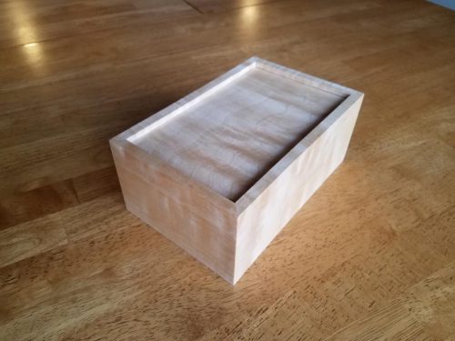
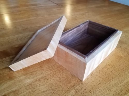
I was happy to finally share a project I made a few weeks back. I laser cut a tree out of a piece of cherry plywood and then dug a mortise out of a block of walnut to hold the tree. The idea is that this can sit on her dresser and hold small jewelry. I used a random scrap of walnut and it had some beautiful grain in it that was perfect for this project.

I didn’t invent this so if you’re interested you can see lots of variations of this idea on Etsy and various craft sites.

Montana Trip Photos

We took over 1000 pictures on our trip out to Fort Peck, Montana, but here are a dozen of my favorites. The building in the field is the school where Don’s mom taught, the farm pictures are from the two farms that Don grew up on, and the military pictures are from a memorial for all the people from northwest Montana who served in the military.

Montana Reflections

This was my second time driving in Montana. The first was a ski trip to Big Sky so I only got as far east as Missoula and everything was covered in snow. This time it was in 90-100 degree heat and I went ~80% of the way across the state. A few thoughts…

  • I was surprised how far the mountains/hills stretched into the state. I thought they stopped around Missoula but there are some decent hills all the way out to Havre and even beyond.
  • The speed limits are really fast: 80 on the interstate and 70 on the two lane roads. If you’re going 5 over you probably need to slow down for some of the corners. Don’t count on a corner sign to tell you to slow down.
  • Passing is pretty easy on the two lane roads if you encounter someone, but watch out because pretty much everything is a passing zone. Just because you have a dotted line doesn’t meant that there isn’t a dip in the road hiding a car or even a corner.
  • Drivers were really courteous. It’s refreshing to get more than a few hundred miles from a coast and see how nice people really can be.
  • It’s beautiful! I was sucked in by views that stretched out for many miles across rolling hills full of wheat.
  • Growing up in northern Indiana, I felt like I lived out in the country. That phrase has a different definition in Montana. Going across highway 2, we passed more than a few towns that were only marked by a small dirt road heading off into the distance and a green sign indicating that there was a town there somewhere.
  • There are a lot of pickups in Montana. I wish I could find a statistic for per capita truck ownership. Montana has to be high up on the list. A lot of those trucks have grille guards on them and it’s not hard to see why with all the dead deer on the sides of roads.

I dream about where I’d live if I had access to plenty of money and didn’t need to make more. Montana is probably in the top 3.