Studio711.com – Ben Martens

Outdoors

Twin Falls

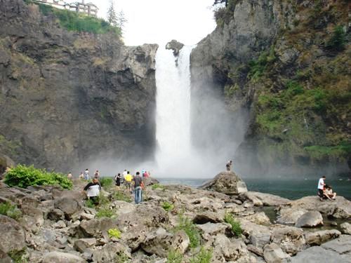
After my abysmal physical performance on Friday, I was pretty down on myself so I decided I need to get back on the trail and prove I wasn't a tub of lard. After church on Sunday, I drove to exit 34 and found Twin Falls State Park. The trail is not very strenuous (2.2 miles each way with 1300 cumulative elevation gain) so I set a quick pace and didn't take any rest stops. That was the plan anyway, but I did end up stopping at two points along the trail to view the amazing waterfall. It's not as big as Snoqualmie, but the hike up there makes it much much less crowded. If you click the image on the right, you'll see a large stitched photo of the full falls. It's hard to get a perspective from a picture like this, but the falls are 135ft high and about 30ft wide.

Our book of trails says this is a 2-4 hour hike, but I pounded it out in 1 hour and 23 minutes, and according to the GPS, I was stopped for 11 minutes of that time. As I came back across the bridge over the falls which is 1.2 miles from the trailhead, I crossed paths with the two groups that had left the trailhead at the same time as me. In the time it took them to go 1.2 miles, I had gone 2.2 miles up to the top and then 1 mile back down to that bridge. That brought a smile to my face.

The top of the trail connects with the Iron Horse Trail. That's the old railroad grade that goes all the way up to Snoqualmie Pass and includes a 2.2 mile long tunnel under the ski area. Tim and I have plans to ride our bikes down that one of these days so it was nice to see what the trail actually looked like.

This was the first time that I have ever hiked by myself. It was a great way to recharge my batteries, clear out a head that has been consumed with a lot of thoughts lately, and get in a good workout. After getting home, I proceeded to spend the rest of the afternoon on the couch watching NASCAR, but somehow I didn't feel too lazy which made it even better.

More pictures are available in the photo gallery under Outdoors > Twin Falls.

Skiing in June

A guy on my team at work, MikeD, has been talking to me about backcountry skiing for the past year. He did it for a long time in Colorado before moving to the Seattle area. He finally convinced me to give it a try, so Friday morning we set out for Camp Muir on Mt. Rainier.

The hike starts off at Paradise at an elevation of 5400' and goes directly up the mountain to Camp Muir at 10,188 ft. That camp is the basecamp for groups attempting to make the summit at 14,400'. Our hike was about 4700 vertical feet in 4.5 miles. That's about constant 20% grade which is much steeper than most road hills you'll encounter. For comparison, Lombardi Street in San Francisco is 31.5%. This route was steep.

Normal ski gear won't work for something like this so I rented a few things from Marmot Mountain Works in Bellevue. I got an avalanche beacon (for being rescued or for locating the position of a fallen skier), fat powder skis (Black Diamond Vertex 180s with a 100mm waist!), special climbing ski boots and climbing skins for the base of the skis. The skis have special randonnee bindings on them. The heel of the binding can come out of the ski and hinges on the toe. The skins that stick to the bottom of the ski allow you to slide forward but give you traction when you step uphill. What all this gear allows you to do is climb straight up a hill on your skis in a fairly comfortable motion. It took a few steps to get used to but after the first five minutes I was in the groove.

We expected to hike the first mile or two with our skis attached to our large ~30lb packs. Boy were we surprised when it started snowing well before we even reached Paradise! By the time we got to the parking lot, the Subaru was plowing through 5-6 inches of fresh snow and it was still coming down fast. (3-4 more inches fell while we were there and a foot was expected by Saturday morning.) While we were in the parking lot, I heard one of the summit guides talking to someone at Camp Muir. They had 40mph winds, zero visibilit8y, and extreme avalanche danger up there. Everyone was snowed in. Yikes! We knew we probably wouldn't be able to get all the way to the camp but decided to go up as far as we could.

Mike led the way and we started plowing our way up the trail with Mike being nice enough to break a trail through all the fresh snow. I made it less than a quarter of a mile, vomited, and felt like I was going to pass out. WHAT?! It was one of the most embarrassing points of my life, but thankfully Mike was very nice about it even though I'm sure he wondered what he had gotten himself into. It took about 20 minutes for the feeling to pass. My only guess is that the combination of ascending 5000 feet in the car and then going at 100% full steam ahead a few minutes later was just too much change all at once. I should have done some laps around the car or something.

Mike offered to show me how to assess avalanche danger to give me some more time to recover. We headed off the main trail, found a suitable spot and started digging. Basically you are digging a deep pit to look for the different layers of snow and see if there are any large variances that could sheer off. The snowpack looked pretty good so there wasn't much danger down there. I was amazed that there was still 6-10 feet of snow in most places.

After that, I decided I was ready to push on, and from there on, things went much better. Don't get me wrong, I wasn't able to keep up with Mike, but I was able to set a steady slow pace. Actually it was probably about half the speed that he was going which was still embarrassing, but at least I was moving uphill again.

When we reached 6150' feet, we stopped to eat some food. We had been on the hill for a couple hours now and it was time for a break. By this point the weather was getting really nasty so Mike and I dug a snow pit, sat down inside and at our lunch. As we sat there, one of the guided summit groups came back down past us. They had made it up to Panorama point at 6900 feet and decided it was too bad to continue. After finishing our lunch, we decided that we should probably head back as well. While I readily admit that I would not have made it to Camp Muir at that pace, I would have liked to keep going at least a bit further. Unfortunately it just wasn't safe to keep going. The ski down was going to be very difficult because we couldn't see much ahead of us.

In retrospect, we could have picked a better route down, but it was still incredible to be skiing down huge open valleys with at least 10 inches of fresh snow. Those fat skis were incredibly fun and gave me a lot more flotation than I'm used to. We ended up being about a mile west and a little lower than the trailhead so that meant it was time to put the skins back on and continue the hike.

When we got back to the trailhead at Paradise, we headed into the lodge to change into some dry clothes. Komo4 news was there with their video cameras interviewing people. You can see the news video and read the accompanying story on the Komo4 news site.

All in all it was an incredible day. I've spent many ski days in conditions like that before, but it was a shock every time I remembered the date was June 6. I can't thank Mike enough for answer all the questions I had about the whole process, for breaking trail the entire trip, for putting up with my crazy sickness at the beginning, and for waiting for me to catch up the whole trip.

The whole event was an order of magnitude harder than I had expected. I knew it would be a challenge, but I considered myself in fairly decent shape. Wrong. Carrying a 30 pound pack and tying 5 pound weights to your feet while climbing up a 20% slope was an incredible challenge. We ended up hiking over 3 miles and 1200 vertical feet throughout the day which isn't too shabby.

I do want to try it again, but I have a lot more training to do. Hopefully Mike will be willing to take me up again, but next time I'll probably choose a smaller hill to tackle and I'll train heavily before we go. I'm considering buying some leg weights and wearing those on our weekend hikes since those don't usually stress me out too much. I'm also considering attempting to make it to Camp Muir later in the year when most of the snow has melted. The last two miles will still be on a snowfield, but we shouldn't be running into a blizzard! This trip put a damper on my thoughts of summiting Rainier next year. I'll have to see how the second attempt at Muir goes later this year.

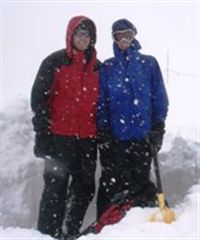
I didn't take many photos since I spent most of the day trying to keep up with Mike. Thanks to Mike for sending over some of his pictures. You can find them in the photo gallery in Skiing > Paradise. The pictures didn't come out great but it's due to the heavy snow that fell all day!
Mountain Biking

Tim and I have been enjoying our bikes down the street at Soaring Eagle Park. On Memorial Day, we decided to try to make a little video. That basically consisted of us riding around until we found a mud puddle or bridge, setting up the camera and riding past it. We’re clearly not very great at this yet, but we have a good time. You can tell us apart in the video because Tim has the blue backpack and I’m the guy with the Under Armor pants and white shirt.

You can watch the flash version below or download the full video.

Get the Flash Player to see this player.

Rattlesnake Lake Hike

After I skied on Saturday morning, I met Rachel and Tim at Rattlesnake Lake for hike #10 from our hike book. As you can see from the GPS track below, we walked down to the lake since we had never been there before. The lake looks a bit low and the map seems to confirm that as it shows we were supposedly walking in the water.

Looking up from the lake, it's easy to spot Rattlesnake Ledge jutting out from the mountain. The hike from the lake to the ledge isn't too difficult. The trail is wide and very full of people. It gets a bit annoying at times, but we made great time up the mountain and passed a lot of people. After a quick stop at the crowded ledge, we continued up the mountain and left the crowds behind.

From that point, the trail gets more difficult and there were only a few hikers. We had plans of going all the way to the top, but after we realized there was snow on the last mile, we decided to turn around. Our footwear wasn't ready for that much snow and we would have ended up with cold, soaked feet.

The hike was fantastic and has jumped up near the top of my list. If you go on the same hike, bypass the first ledge and go up another 0.5-0.75 miles to find another smaller ledge that will be much less crowded and offer even better views.

Saturday was good practice for my Camp Muir hike which is coming up on June 6. Mike and I have scheduled vacation for that day, and I rented randonnee ski gear. Hopefully the weather is as beautiful as it was today!

There are pictures in the photo gallery and more panoramic photos. There is a bug in the photo gallery which doesn't let me put these panoramas there, so I'll leave them in this post. I think they help to communicate the vast views better than the single photos.

Geohashing

Rachel and I have been chatting about trying to do a little geocaching instead of regular hiking. Today's XKCD comic presents an idea called geohashing. There is a formula to figure out a geohash location. The inputs to the formula are the date, that date's (or most recent) Dow opening, and the integer lat/lon of your current location. The formula includes an MD5 hash and is pictured below. There is an app already written to calculate each meeting spot and there is a wiki with more info.

I'm not going to bother to explain what all that means, but if you need more help, you can click on the links for extra learnin'.

Sunday Ride

Rachel and I hopped on the motorcycle on Sunday and went exploring. The first interesting site was the split in the road pictured below. You can click on it for the full view. The road splits and both directions have a Dead End sign. I feel like this is a good cover for a motivational book, or maybe there's a sermon topic in there for you Pastor Scherschel.

All of our exploration ended in either dead ends or dirt roads. (Jay, if we had your Jeep out here, we could drive on dirt roads to some incredible places.) We backtracked back down to the main road and headed for Snoqualmie Falls.

I've been to the falls a number of times, but it's still one of my favorite places to show people. It's my way of saying, "See how awesome Washington is? This place is 14 minutes from my house!"

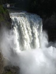
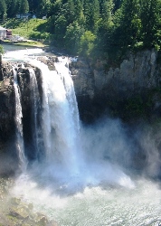
The near-record snowfall in the mountains coupled with the record warm temperatures has created a very fast melting snowpack that is sending flash floods down the hillsides. I was shocked at how much water was flowing over the falls. I've never seen anything close to it. Check out these comparison shots. I think it will be easy to tell which ones were from the weekend and which were from a previous summer.


I don't have a comparison shot for this last picture because the river is so high that all of these rocks are underwater. The normally calm river where people go tubing has turned into raging rapids.

Speaking of record snowfall, Alpental is staying open for another weekend. What an incredible ski season!

Paintball

Over a month ago, we semi-randomly picked a weekend to play paintball. What a day it turned out to be! We had record setting 90+ temps and blue skies. Eighteen of us (mostly Microsofties) headed to Eastside Paintball for a day o' carnage.

Beware all who travel to Eastside Paintball. Tim and Denis were really the only people who had vehicles that looked at place on that road. As I carefully picked my way through the pot holes, mud spots, and big rocks, I could only imagine how much Greg was going to be gunning for me after driving that road in his Porsche. Oops.

Thanks to everyone who came out. I think we all had a good time and I hope that we can do it again soon! Pictures are available in the photo gallery.

Summit Registers

Since we found that summit register on top of Cougar Mt., Rachel and I have been wondering where those books are kept. The register at the top of Mt. Rainier is kept in the National Park Archives.

Until the 1930s, the park did not maintain formal park summit registers. During the early years, many different mountain climbing clubs maintained registers at the summit. The Mountaineer’s collection of registers is located at the University of Washington. The Mount Rainier National Park Archives contains summit registers beginning in 1932.

Registers continue to be added to the collection. If you are searching for a very recent signature, please be aware that there is a time lag in getting registers to the archives for processing. Though some summit register pages are damaged and some volumes are missing, the registers are still an excellent record of Mount Rainier summit climbs and provide the reader with an opportunity to "read the thoughts of the climbers."

To initiate a summit register signature search, please be prepared to provide as much information about your climb as possible: the number of people in the climb, if you were in a guided party, how you wrote your name, etc. Providing the exact date of your summit climb or as close as possible to the date of your climb, is the most important information for ensuring that your signature has a chance of being located.

http://www.nps.gov/mora/historyculture/museum.htm

An email to the King County Parks and Recreation website revealed the destination of the Cougar Mt. registers:

The books are read and stored at the Cougar Mountain Regional Wildland Park maintenance office. Staff tells me they are very interesting reading. If you would like to review any of them, please call the maintenance office at 206-296-4145.

This seems like a good book opportunity to me. Imagine how many funny, inspiring, heartbreaking tales are recorded on those pages!

Cougar Mountain

On Sunday, Rachel and I met at the Cougar Mountain trailhead for an afternoon hike. The weather was perfect for hiking – 65 and sunny. The hike came from a book of local hikes that Tim bought last summer. It's the first one in the book (seemed like a good place to start.) While there wasn't a lot of great scenic views, it was a good workout and a nice chance to chat for a few hours. We made the 6.2 mile hike with 1700 miles feet of cumulative elevation gain in exactly three hours.

I was pretty excited to reach the peak and see what was in store. Unfortunately, I still don't know because there is absolutely no view. It's just the highest point on the hill and it's surrounded by trees so you can't see anything. There was a couple up there who had just moved to Seattle from Chicago. We shared a laugh about the anticlimactic summit and then they took off.

Rachel grabbed the notebook out of the tuperware box and proceeded to read through entries from previous hikers. Along with various comments about people who claimed to have peed on the pen, there were some interesting notes. The first was something to the effect of: "Been here for three months. Running out of food and water and the squirrels have stopped talking to me." The longest entry (three pages!) was from a 24 year old girl who was in love with her 57 year old professor. She was on a hike to figure out what it all meant and straighten things out in her head. I feel like she probably failed.

I'm hoping that there will be many more hikes this summer so I have started a hiking photo gallery. Pictures from this hike are available in the gallery.

UPDATE: Thanks to Dad for catching my units error. It's probably not that surprising if you remember that I worked for Lockheed.