Looking back at the history of skis, there are some obvious major advancements in technology. Early skis were slabs of wood that you would strap your feet to, but skiing really started to gain popularity with the masses when rigid plastic boots and break away bindings were introduced. In the mid-90’s, the skiing industry discovered shaped skis. This meant that the part of the ski under your foot was thinner than the ends. It greatly improved skiers ability to carve in turns, keeping the whole ski in contact with the snow in a big arc.
About ten years ago, the industry started another big shift. This time it was called “rocker.” The diagram below shows the older camber shape with the new rocker shape.
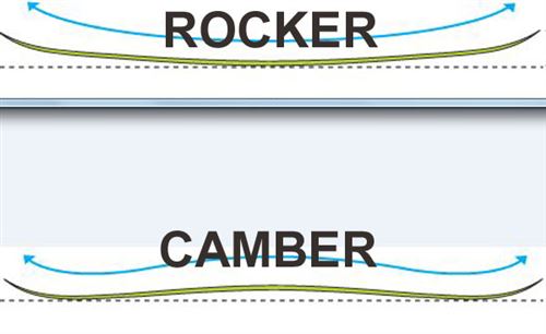
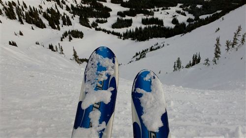
The goal of a rockered ski is to float on top of powder, but the problem was that the early models were horrible on groomed runs. The tips would flap around and there was hardly any edge contacting the snow when you attempted to carve. Modern rocker skis are a combination between the older camber and the newer rocker. Here’s a side profile of the 2013 Salomon Rocker 2 108.

This might look roughly like the camber diagram, but the major differences from cambered skis are that these new rocker skis are much flatter under foot and the rise to the tips starts early. It’s not a “fully rockered” ski since those are best kept for pure powder skiing which very few of us do. I’ve been reading about rocker in magazines for a long time, but it has finally gotten to the point where I felt like it had potential to be an all-mountain ski. Conveniently I’m in the market for some new skis this season.
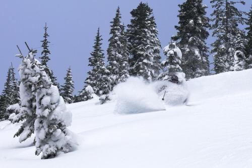
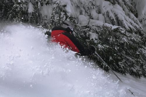
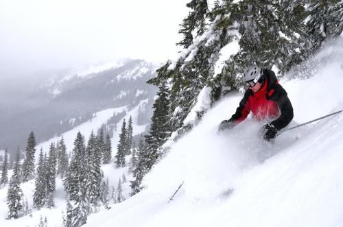
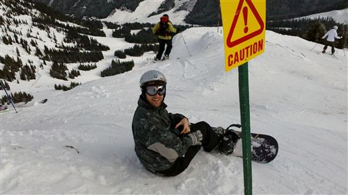
This last weekend I demoed a couple pairs of skis at Crystal to figure out what I might like. I’ve never skied a rockered ski or even a ski as fat as modern skis so I wanted to try them before plunking down that much cash. Based on my research I started with the Salomon Rocker 2 108s. They are 108mm underfoot (my current skis are 79mm) and they have rockered tips. The morning was cold and blustery with hard packed bumps off piste. I theorized that any new ski would be better in the powder than my old skis so I wanted to test the rocker on groomers. I was immediately impressed. They weren’t quite as good as my Bandit B2’s on the hard groomers, but they were plenty good. And as fresh snow started to fall, I ventured off the groomers and fell in love with the skis. They handled every condition I could find with an ease I had never experienced. They were so much fun that I had a hard time going back to the demo shop to switch them out for something else.
I asked the sales guy what he recommended and he pointed me to the Blizzard Cochise. The measurements are similar to the Salomons, and I didn’t notice a ton of difference on the groomers. But as good as the Salomons were off-piste, the Blizzards were even better! I was doing things with those skis that I had never done before. It felt like in 30 minutes I gained more skill than I’ve gained in the last year. The snow was falling pretty fast and I found some powder stashes to play in. I’ve always been frustrated with powder in the past because I couldn’t ski it like I knew I should be able to, but with these skis it was a breeze. The groomers had collected a lot of snow and there were large bumps of packed powder. With my old skis, I had to ski around and between them, but with these new skis, I was able to pick my own line regardless of the bumps and just skim over the top. It’s something I’ve watched other people do and had no idea how the physics of it worked. Now that I had the same skis, it all made sense.
As you can probably tell, it’s hard to describe the feeling and how much I felt like it elevated my skiing. The best description I’ve come up with so far is that it’s like a baseball player who has been using a wood bat all his life and switches to aluminum. You can use it the same way but you get a big difference in the result, and then as you get better with it, you realize there are additional capabilities. I’m by no means an expert and I have a lot to learn, but these new skis could give me the confidence and tools to increase the rate at which I improve. I’m going to sit on it a couple more weeks and then make my decision right after New Year. I can’t wait!

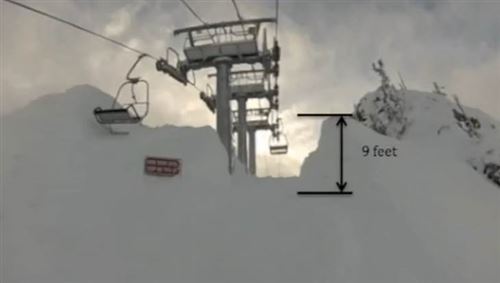
 On Saturday I headed to Crystal again. They have gotten a lot of snow since last weekend and the base area really showed it. I could ski all the way to the bottom without much trouble. I didn’t need the rock skis today!
 I have an amazing wife. Not only is she carrying our child, but she agreed to let me get a season pass to Crystal and Snoqualmie this year since my skiing opportunities in the future will be quite a bit different. Thank you Tyla!
 I’ve been hard at work getting a new version of the
 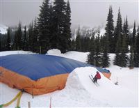 Crystal Mountain recently installed a giant air bag. They put it underneath a jump so that people much younger than me can practice their jumps without much fear of injury. I just had to know what it felt like so last weekend Tyla and I went down to Crystal along with a couple friends from work, Andy and Aim.
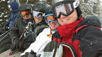 We’ve had an interesting winter. It started off with a bang, dried out for quite a while, and now we’re getting alternating snow dumps and rain. I skipped the pass again this year and again I wonder if that was the right idea. My plan was to pick out the best days, take vacation, and go skiing, but that hasn’t happened yet.
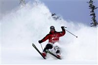 Every October, Microsoft has a big auction for charity. Employees can put things up for other employees to bid on. Four years ago, I won a day of semi-professional ski photography.
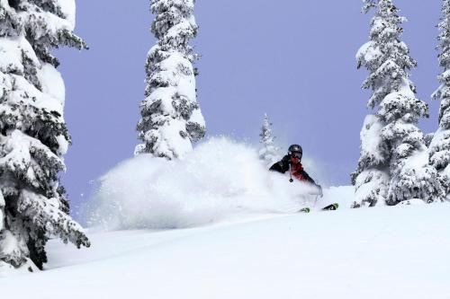