Studio711.com – Ben Martens

San Juan Islands

Saturday morning started dark and early as I headed over to Kirkland to pick up Tyla. We made our way up to Anacortes and caught the 8:45am ferry to Friday Harbor. The ferry ride is a gorgeous one hour trip through the islands.

Tim from San Juan Kayak Expeditions was waiting for us as we walked off the ferry. He drove us down to the beach and gave us a very thorough overview of how to use all the gear, safety information, and tips for a successful trip. He also suggested a great route that took into account the wind and tides. Since Tyla and I are both kayaking newbies, we chose the easiest route.

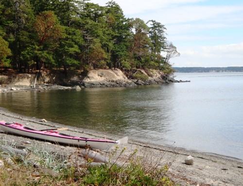
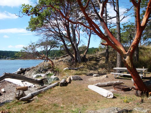
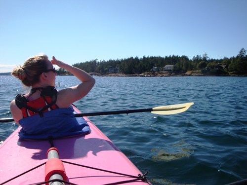
We rode past a couple rocks that were covered in seals and ended up at a tiny island which might have just become my favorite summer spot in Washington. You can walk around the whole island in 20 minutes but it's actually a state park. There are about a dozen campsites which are only accessible via boat. Tim said it gets pretty crowded in the summer but mentioned a couple quieter islands nearby. I'm already planning the camping trip in my head. The usual camping crew should prepare themselves for an incredibly awesome camping trip next year. The first picture below is looking east from the campsite and the second picture is looking back west at one of the campsites. The third picture is Tyla checking out the seals.

We felt like we had the whole island to ourselves and only found five other people on the island during our hike. After a nice picnic lunch (with Liz Lovely cookies for dessert!), we meandered our way back, taking time to watch the seals. Tim picked us up and drove us back to the ferry for the trip home.

All in all it was an incredible afternoon. I know you can rent kayaks down by the arboretum for a lot cheaper, but the scenery and the equipment are no comparison to what we got from that rental company. I think I speak for both of us when I say this is a highly recommended trip! We'll be doing it again.

Whistler in the Summer

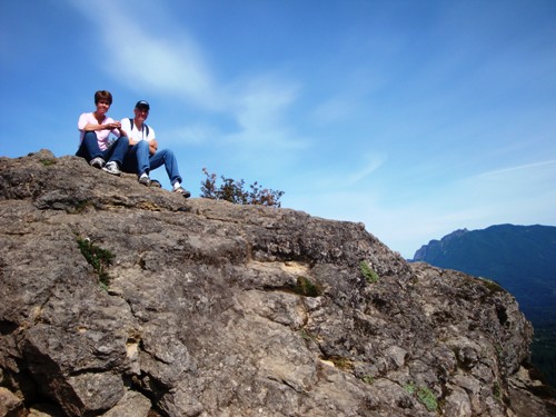
Mom, Dad and I spent the weekend in Whistler. I wasn't sure what to expect there in the summer, but it was a blast. The weather was a bit foggy the first day but it didn't deter us much. The second day was full of sunshine and we had some great views. And we got actual snowfall at the peak on both days (no accumulation though.)

The main events on our trip were hiking down Harmony Ridge past Harmony Lake, the zip lining 100 feet above Fitzsimmons Creek, and hiking the new High Note trail around the south side of Whistler Peak. Oh and of course we ate some great food and found things to buy in the village.

This was the first time I stayed in the Windwhistle Condos (#402), but it won't be the last. It's located right in the village above the Whistler Grocery Store (near Citta's Bistro and the Amsterdam Cafe.) That condo could sleep six and has two separate decks overlooking the mountains. You can find the info on alluradirect.com if you're interested.

Plenty of pictures have been posted in the photo gallery. You can also click on the panorama below for the full size version. And finally, I have embedded a video of one of Mom's zip line runs.

Rattlesnake Ledge

It is Mom and Dad's last day in town so I took them on a hike up to the top of Rattlesnake Ledge. It was a pretty nice day so we had a great view from the top. I, of course, took another panoramic photo. You can click on it for the full size view.

Ride Photos

I forgot to add photos into yesterday's post about the ride, so here we go. Head to the Motorcycle gallery and look at the newest 10 photos there for a glimpse of what we were up to. There were so many great photo opportunities along the way, but we were having too much fun riding to stop!

720 Miles

The longest ride I've made in one day was around 400 miles. I didn't break my single day record this weekend, but it was the longest overall trip I've ever done and my first overnight trip.

As I mentioned previously, the ride started yesterday with Tyla and I taking a trip through Stevens Pass to Leavenworth and ending at The Gorge in George, WA. I was a bit nervous about taking her on a 220 mile ride, but she did great and was even comfortable enough to fall asleep for a bit. (Don't worry, it's not as unsafe as it sounds. Ask Laura. She does it all the time with Matt.)

On Saturday, I met BenH (from work), MattM and Dustin (one of Matt's friends) in Ellensburg. I was a bit nervous about our 270 mile day since I had zero sleep the night before. I grabbed a one hour nap while the three of them ate breakfast in Ellensburg. You know you're tired when you can pass out in laying on blacktop in an Arby's parking lot. That nap refreshed me and we took off on a gorgeous ride down Canyon Road to Yakima. The scenery on the east side of the mountains is so different from over here. I wish I had more pictures but I really felt like I was in a miniature Grand Canyon. If I dropped you there, you'd swear you were in the southwest somewhere.

When we hit Yakima, we headed west on Highway 12 which provided some amazing views of both Rainier and Mt. St. Helens at the same time. I also spotted Mt. Adams and what I believe was Mt. Shushkan. If you look at those on a map you'll realize what an incredibly clear day it was. Those mountains stretch from almost Canada down to southern Washington.

The highlight of the trip was definitely NF-25 and NF-90. They are national forestry roads and they were a complete blast to ride. I wish I had some device that measured how often my bike was upright (traveling in a straight line.) I bet we were in corners 90% of the time and those roads stretched for about 60 miles. It's highly recommended. Keep your speed in check though. Those roads are not well maintained and contain many many bumps and dips in awkward spots. When you're on those roads, it's easily two thirds motorcycle traffic.

The three other riders took a trip up and back to view Mt. St. Helens. This was about 1pm in the afternoon and I was feeling tired again. I let them take that little spur and I caught a great nap on the side of the road.

We stayed overnight in Vancouver, WA and had dinner at Red Robin (where else?) I was anti-social and went to bed early to catch up on some sleep. 11 hours later I was finally feeling refreshed and ready for the drive home.

We took much the same route home except we came up the east side of Rainier instead of going back through Yakima. Unfortunately we got a bit split up, but we all made it home safely. It was raining pretty hard by the time we got home, but if it has to rain, it's nice to have it happen when you're an hour from home.

All in all it was an incredible trip. I wish I had more pictures, but I was having so much fun driving down those roads that I didn't want to stop. A motorcycle was the perfect way to experience this trip. It made me even more sure that it's time to upgrade my bike. I even got to chat with someone at a gas station who owned the bike I want (2008 Concours 14.) We'll have to see what happens in my bank account but this might be in my future. That 720 mile trip would have been much more comfortable (and fast) on the Concours. My bike held up well though so I can't complain.

Thanks to all the guys for letting me come along and thanks to Matt for planning everything. I only have one question: where are we going next?!

Pacific Gaper Clam

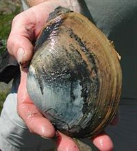
When we were walking along the beach at low tide, we were startled when streams of water started shooting up around us. Most were only about a foot high but some shot four feet up in the air. We couldn't see what was causing it, but after some research, I think I have figured it out.

The mystery animal is a Pacific gaper clam, also called a horse clam. They live 6-12 inches under the surface and have a long "neck" that sticks up to the surface as a siphon. When they are startled, they quickly retract the siphon which shoots water up into the air.

It was hard to get a photo since each shot happened so quickly. I took a bit of video which is embedded below. I don't know if you can pick out the streams of water. There's one at 0:03 seconds in the lower right quadrant, one at 0:08 on the right middle, and one at 0:14 on the left side.

Fort Flagler Camping Trip

What a weekend! As I mentioned in the last post, the whole crew headed to Fort Flagler State Park on the northeast part of the Olympic Peninsula. Tim, Chelsea and I got there on Thursday night. We set up the tents, had a quick fire and then headed for bed.

On Friday we explored the beach area a bit and played a lot of cornhole. Throughout the evening, Tyla, Andy, Stephanie, Matt and Laura arrived. For dinner on Friday, we took our Mexican aluminum foil food packets down to the beach and ate in front of a gorgeous sunset.

Saturday was the day for the big hike through many of the old fort installations. It's hard to imagine the amount of firepower that was aimed out into the Puget Sound. I would not have wanted to be on the receiving end. It's no wonder that the bunkers are all still in tact. I don't know how you would have gotten close enough to take them out. We followed that hike up with cornhole, another gorgeous sunset, and some great dinner courtesy of Laura.

On Sunday we packed up the campsite, spent a few more hours walking along the beach at low tide and finally headed home. We had to wait over an hour for the ferry back, but it was a smooth trip. I'm sure ferry rides get boring after a while, but it's still pretty new to me and you can usually find me out on the observation decks.

With eight people at the site, it was the biggest camping trip I've had out here. From early morning walks on the beach to late night chats around the campfire, it looked like everyone was having a great time. There were well over 1000 photos snapped on various cameras throughout the trip. I've picked through the ones that Chelsea and I took and posted some in the gallery. A few of my favorites are shown below.

Where in Washington is Ben?

This weekend is our second camping trip of the year, and it's a big one! Our campsite is packed as full as they allow. Campers include Laura, Matt, Andy, Stephanie, Tyla, Chelsea, Tim, and me. Chelsea, Tim and I are getting a heard start on everyone else. We actually arrived at the campsite last night and everyone else is coming this evening.

The popular state parks fill up very quickly. We find the more popular parks by looking far ahead and seeing which ones are booking up. Washington has a great online booking system which makes this easy. On the last day of 2007, we hopped online and reserved a campsite at Fort Flagler. It's over on the Olympic Peninsula so we'll be hopping on a ferry to get there.

The website lists some interesting history for the park:

Fort Flagler, along with the heavy batteries of Fort Worden and Fort Casey, once guarded nautical entrance to Puget Sound. These posts, established in the late 1890's, became the first line of a fortification system designed to prevent a hostile fleet from reaching such targets as the Bremerton Naval Yard and the cities of Seattle, Tacoma and Everett. Construction began in 1897 and continued in one form or another until the fort was closed in 1953. The property was purchased as a state park in 1955. Fort Flagler is named after Brigadier General Daniel Webster Flagler.

As you probably guessed, our weekend will be full of good food, good times, and plenty of cornhole! Pictures will be abundant next week. Have a great weekend!

Mt. Baker

The Mt. Baker ski area isn't actually on Mt. Baker itself. There's a road that continues a few miles past the ski area to take you to a nice viewing area of the mountain in the summer. I've never been all the way up there and was thinking about taking a ride there this weekend. After looking at their website, I quickly realized that's not an option.

They're still trying to get the road cleared and are having to plow through snow that up to 20 feet deep. In the four day work week before the Fourth, crews cleared a total of 1/3 of a mile. There are lots of rocks in the snow which bust the snowblower and cause downtime for repairs.

You can see more information about the effort on the WSDOT site and their Flickr gallery.

Iron Horse Trail

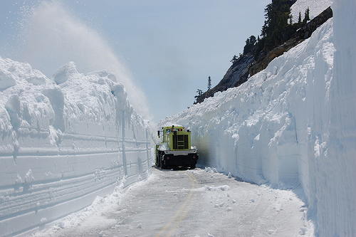
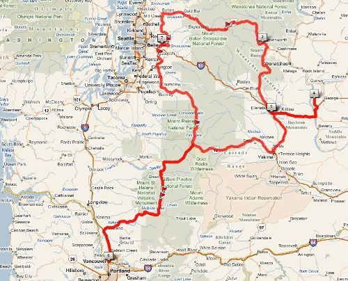
On Saturday, Tim and I dropped a car off at Rattlesnake Lake and drove his truck up to Hyak at the top of Snoqualmie Pass. The Chicago, Milwaukee, St. Paul and Pacific Railroad used to connect those two points, but in 1980, the railroad went bankrupt and the railroad grade was turned into the Iron Horse Trail. The trail is part of the John Wayne Trail which continues east all the way to the Idaho border.

The Snoqualmie Tunnel is at the top of the trail. It's 2.3 miles long, and even though you can see a tiny point of light in the distance, it's absolutely pitch black when you shut off your headlamps. We couldn't see our hands in front of our faces. Bring a powerful headlamp. You'll need it. Even with the headlamps, if we looked up from the ground in front of us and focused on the light in the distance, we'd quickly start wobbling and running off the trail toward the walls. It's crazy, but really fun.

After the tunnel, we made good time down the rest of the 22 mile trail. We hit some rain along the way, but we were prepared with rain jackets and it wasn't too bad. All in all, it was a pretty cool trip, although it wasn't nearly the workout I had expected. The road is extremely well maintained and it's very smooth and flat since it was a railroad grade. We finished the ride in well under three hours.

While we used two cars to avoid riding both ways, we found out there is a shuttle that runs back and forth so look into that if you want to follow in our tracks.

A few more pictures are available in the photo gallery under Outdoors > Iron Horse Trail.