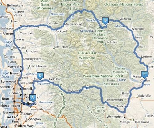
 I’ve driven the road from Bellingham to Mt. Baker a few times, but it has always been in the winter with skis on top of my car. On Saturday, I did it on the motorcycle.
BenH and I met up at Denny’s for breakfast. Tyla joined us too since it was right by her apartment and then headed off for a day of shopping. Ben and I pounded the pavement all the way up I-5 and then headed east on 542. It’s a fantastic drive and a great motorcycle road. Once you get up to the Heather Meadows base area, you can continue past up to Artists Point. Skiing there in the winter, I had no idea there was a road there. A mile or two through some incredibly tight switchbacks (don’t take your RV) take you up to the top of Artists Point where you are greeted with a 360 degree view of the surrounding mountains.
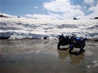
This is the earliest that the road has opened in a while. It usually takes them until later in the year to clear out all the snow, but due to the low snowfall last winter and the hot weather this year, it went faster than normal. You could still see spots where the plows had carved through drifts 6-7 feet high.
We hung around for a while at the top, took some pictures, watched kids sledding, and wished we had brought skis. You could get in a football field or two with about 100-200 foot drop. Nothing serious but not bad for July and August.
On the way back, we made a minor deviation and cut down US 9 to US 20 and then back down I5. It’s about 10 miles shorter than going through Bellingham and I think it’s a little quicker.
At a gas station in Burlington, we met a couple guys who were traveling the country on their bikes. They have been gone for a couple months and one of them was from Kokomo, IN (the Indiana license plate sparked the conversation.)
All in all, it was another great ride. I love the feeling you get after a long ride when you feel completely in tune with the bike. It really makes me want to take a long multi-day trip.
I was also reminded how much safer it is to ride with another biker beside you. We rode almost 250 miles together and then split up for the last 10 miles. In that 10 miles, I was almost hit three times. Two people on the highway merged halfway into my lane before they saw me and then somebody tried to make a left turn into me coming off a side street. I know we’re small and hard to see, but it’s summer. Please double check those blind spots. And if you see a motorcycle approaching in your rear view mirror, make sure you know where they are before you change lanes. If you don’t see them, don’t assume they turned off.
Photos are available in the photo gallery.

 If you’ve read
 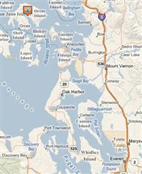 Every year around December, we check out the Washington State Parks website and see which campgrounds are filling up. There are usually some good campsites left at those parks and we snag one for the following year. Previous trips have been to Deception Pass and Fort Flagler. This year it was Moran State Park on Orcas Island.
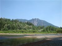 Sunday was another hot day, so Tyla and I decided to take a little adventure. Three Forks Park (just north of North Bend) was one of the first places I discovered on my motorcycles rides. It’s not much of a park, but it is a good place to access the Snoqualmie River about a mile upstream from the
 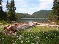 Saturday was our one year anniversary. 365 days ago, Tyla and I had our first date, and for some reason, she has put up with me for a whole year. To celebrate, we drove down to

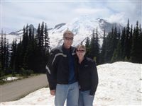 On Sunday, I hopped back on the bike for another ride. I recovered surprisingly quickly from the 440 miles on Friday. This ride took Tyla and I down to Mt. Rainier. It’s a very nice ride covering mostly two lane roads and then a very nice windy road up to Sunrise lookout. There was heavy traffic, but not as much as I was expecting considering the holiday. Plus, traffic always seems lighter on the motorcycle since it is much easier to pass.
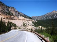 Not only did I survive the ride on Friday, but I thoroughly enjoyed it! I took almost the exact route that I talked about in the