
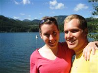
 Tim, Chelsea, Andy, Stephanie, Nick (an intern at Tim’s company), Tyla and I spent the weekend about 15 miles east of the summit of Snoqualmie Pass at Lake Easton State Park. We all convened at campsite 109 after work on Friday and crammed five tents onto the tent pad. The rest of the weekend was filled with cornhole, beverages, campfires, delicious food, and hanging out down by the water. The lake was beautiful, but the campground was very loud. I-90 was only a few hundred yards away. I guess when you try to cram train tracks, a lake, a campground and an interstate into a mountain pass, there’s not a lot of leftover room. It was great for a weekend trip considering how close to home it is(60 miles from my house.) On Sunday morning, we packed up and visited Mountain High Hamburgers on the other side of the interstate. It’s a Scherschel family favorite and made a nice end to the weekend.
Thanks to everyone for coming, and special thanks to Tyla for putting up with Nick and me talking about skiing all weekend. This winter he’s going to be living the dream: ski bum at Alta. Combine that with his lifetime full of 100 day ski seasons at Killington and I’m pretty jealous.
The next camping trip on the calendar right now is in late August when we take a trip out to the San Juans.
Photos are available in the gallery.
 On our trip to Indiana, we stopped at Granite City for dinner. It’s one of Tyla’s favorites and I finally got to try the Idaho Nachos that I heard so much about. Last weekend we decided to try and make them for ourselves. I think they actually tasted better than the ones from the restaurant!
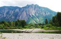 If you spend much time in this area, it doesn’t take long to recognize Mt. Si. Just east of North Bend, this chunk of rock is about 4200 feet above sea level. The hike to the top is 4 miles long and gains about 3300 feet. It’s one of the most popular day hikes in the area, but for some reason, I’ve never done it. I can see it when I drive out of my house and it bugs me every day that I haven’t been to the top.
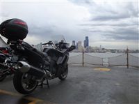 If you live in the Seattle area, it’s probably not too hard to figure out that I love my motorcycle. I’ve been riding it every time I get the chance, and thanks to our incredible weather, I’ve had a lot of chances. Numbers always help to draw comparisons though. I had my first motorcycle for four years and I put 10,000 miles on it. The brainiacs among you will realize that I averaged 2500 miles/year. I bought this new bike in mid-Feburary. The odometer already reads 2700 miles and we’re not even halfway through the calendar year!
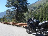 I found myself with a relatively free Saturday morning. It was such a gorgeous day that it would have been a crime to sit on the couch. I fired up the bike and left the house at about 8:15AM.
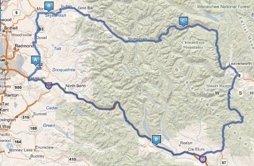
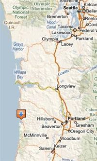 Tyla and I spent Memorial Day weekend camping in Garibaldi, OR with her family. They headed down earlier in the week, but we didn’t leave until Saturday morning in hopes of avoiding some traffic. We met them in chilly Cannon Beach where the wind and cool temps made for a short walk on the beach. Oskar enjoyed the ocean, we had some lunch in town, and then we visited a few shops before heading out.
 The Washington Trails Association website is great for discovering the status of various trails (covered in snow? etc) and finding new trails. They have one great site that lists a bunch of

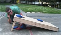 On Thursday night, Tim, Chelsea, Tyla and I met after work to play some cornhole. In the very first game, Tim made cornhole history. I’ve only seen three people have ever gotten three out of four bags in the hole in one inning. (I am one of them, go me.) Four seemed impossible. Until Thursday.
Weekend Recap
Thanks for a great weekend Tyla!