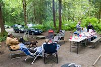
Tyla’s family decided at the last minute to take a camping trip. They didn’t want to travel far so they ended up a couple miles from our old condo in at Tall Chief campground in Fall City. I’d driven by it a number of times but never investigated. It’s a private campground that mostly caters to RVs and campers so you get the pool, hot tub, sauna, shuffleboard, etc. It’s not rugged by any means, but it was very nice and quiet. Their campsite was huge and there weren’t many people around so it was a very enjoyable location.
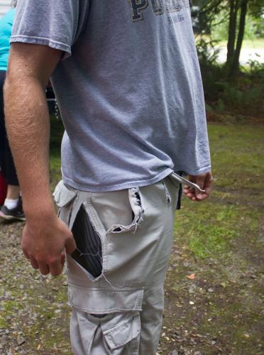
Tyla and I had some other things going on so we just went down for the day on Saturday. It started off with some excitement. I was swinging on the playground and as the swing slowed down I jumped/walked off. Unfortunately my shorts stayed attached to the chain and pretty much ripped off my body! Everyone got a good look at my boxers as I attempted to hold them on my body for the walk back to the campsite.
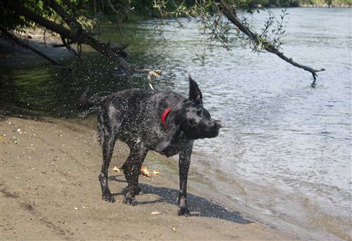
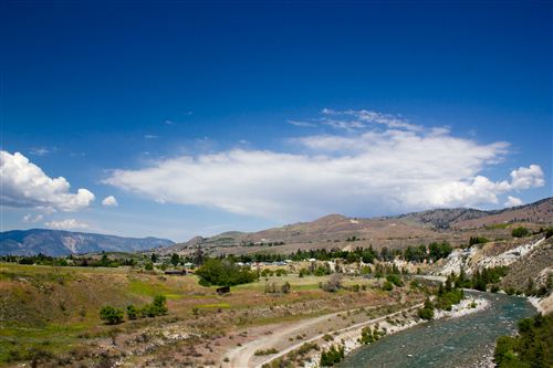
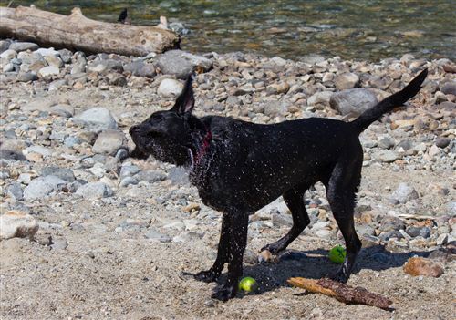
We tried to go visit the Snoqualmie train museum where I volunteered last year, but it was Thomas the Tank Engine day and the place was overrun with little kids. We skipped that and headed down to the river to let Oskar play.
All in all I was very impressed with this little campground that I have driven by 1000 times!
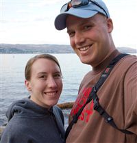
On Memorial Day weekend, Tyla and I headed over to Lake Chelan State Park with her family. It’s on the east side of the mountains, so if you remember your Washington geography, you’ll know that it’s in the desert.
The park is more focused on day use than overnight camping, but we probably had the best trailer camping spot in the park. We bordered the woods on one side so we had some privacy. And even better, there was a small stream running in the woods behind the site that the guys named Pee Creek.
The park does have some incredible tent sites. Each site has room for one car to park along the road and then you carry your gear about 50 feet down to the water. Your tent gets set up on the banks of the lake. There’s no immediate water access since there are about 10-15 feet of huge rocks heading down to the lake, but it’s still a great view. If you have a boat, you can even rent a dock right by your campsite!
The lake itself is gorgeous. It’s 55 miles long and is the largest natural lake in the state. At 1486 feet deep, it’s the third deepest lake in the US and the 25th deepest lake in the world. The bottom of the lake is 388 feet below sea level! I couldn’t find any stats about the cleanliness of the water but it was amazing how far down you could see.
We had beautiful weather all weekend which let us enjoy a lot of time playing with Oskar down by the lake, go for a couple short hikes, and check out the small dam just down stream from the lake.
It’s a very popular destination which means there can be big crowds, but since it’s such a big lake, the boat traffic didn’t look too crowded. When I make my millions, it will be tempting to buy a house somewhere on the lake. Maybe this one will still be for sale.
In a three hour drive home, we went from desert lake to snowy mountain pass to wet coastal region. I love the Pacific Northwest!
A few photos are included below and more are in the photo gallery.
We gave nephew David a kid sized Camelbak for his 6th birthday, and it reminded me of a post I’ve been meaning to do for a while on how to properly clean a hydration pack. Before I met Tyla, I don’t know if I cleaned mine more than once or twice. Turns out she doesn’t like drinking moldy water. Who knew? We now have quite a few of these bladders and I’ve gotten a lot better at keeping them sanitary.
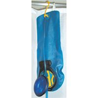
The big problem with these things is that if you crumple them up and throw them in a dark spot, they’re never going to dry out. It’s a petri dish. So the number one task after you use your Camelbak is to get it dried out. You can try sticking something inside like tongs to keep it propped open, but make sure you wrap paper towels around any metal so you don’t get rust inside. You can also break one leg off a plastic hanger and attempt to hang the bladder sideways. I ended up purchasing the hanger that you see in the photo. The hardest part is figuring out how to use it! I haven’t found anything better for getting it completely dry in a fairly short amount of time.
Camelbak officially recommends that if you’re using it regularly, you can just keep water in it, or you can get most of the water out and throw it in the freezer. That should keep you free from most bacteria. It looks like some of their new hydration packs even come with built in hangers!
You can also buy cleaning tablet and brushes specially made for cleaning out the main compartment. Camelbak also sells a lot of replacement parts so you if something gets too damaged or dirty, you can just replace it.
I feel like there are probably better hydration systems out there, but so far I’ve been content with our Camelbaks and we own a bunch of them. If you’re looking to save some money, there are a lot of websites and YouTube videos about alternative ways to dry and clean these things.
Mom and Dad came out for Easter. Since they have only been out here once in the winter (two Aprils ago for our wedding), we thought it would be fun to head up to the mountains to see some snow. It seemed like a good opportunity to try snowshoeing so I stopped by REI and rented some snowshoes.
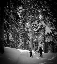
We drove up to Stevens Pass on a beautiful Saturday and parked in Lot 4. From there we walked along the cat track at the south end of the lot and headed back toward Grace Lakes. Since none of us were experts at snowshoeing, it was nice to be able to walk along the cat track though we did venture out into virgin snow. I was amazed at how well they held me up. It worked so well that I figured the snow must have a crunchy layer, but when I took off one snowshoe, I quickly sunk in up to my knee.
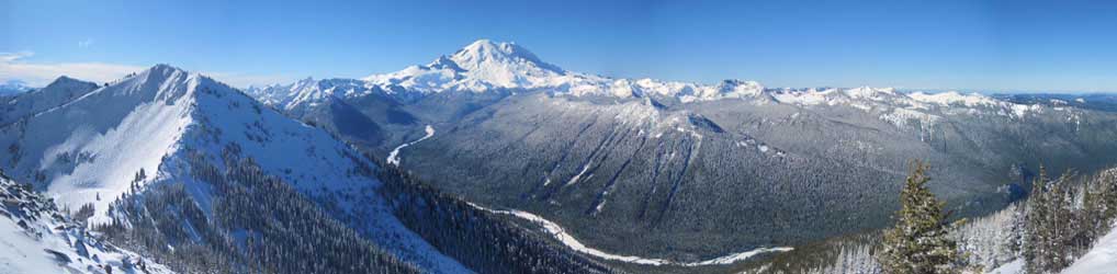
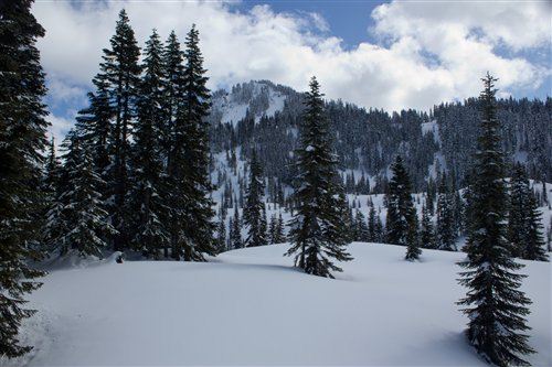
We turned around when we got to a sign warning about avalanche control, but we did get to have lunch on a hill with an incredible view. I snapped off a quick panorama series and posted it on PhotoSynth. Photos are also available in the photo gallery (look at the photos posted April 15.)
I headed out with the Brandt family to Alder Lake State Park for the Fourth of July weekend. It wasn’t our first choice since we got a late start on reservations, but the campground actually was pretty nice. The biggest downside was that it was close to Hwy 7 which is the western entrance to Mt. Rainier, but the traffic died down a bit at night and the fan in the camper drowned out the noise.
Our campsite was just a short walk from a boat launch into Alder Lake and Oskar made good use of that with a lot of swimming. Tyla and I even joined him for a bit. The water is pretty cold since it flows straight off the Nisqually glacier on Rainier, but we had a good time.
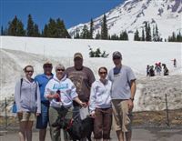
On Saturday, we braved the crowds and headed up to the Paradise visitors center on the south side of Rainier. It was pretty easy to spot the extra dirty snow on the Nisqually glacier from a big rock slide they had last week. (Video is posted on YouTube from hikers.)
On Sunday night we headed up the road to Eatonville to check out their fireworks display. After a couple conversations with the police, we ended up getting booted off the school grounds viewing area because pets were not allowed. We watched from the parking lot, had a great view, and beat all the traffic leaving town.
All in all it was a great trip. We couldn’t have asked for better weather and camping was a great way to celebrate one of the first weekends that has really felt like summer!
We have had quite a few new young couples join our church recently, so we decided to put together a camping trip. Unfortunately I picked a weekend when not a lot of the new people could join us, but we still did get a good crew together for a fun weekend.
Logan, Megan, Micah, Tim, Chelsea, Tyla and I headed south to Kanaskat Palmer State Park. You may remember that I camped there about three years ago. This time we got two sites to hold all the tents.
Camping this time of year is a bit risky because of the weather, but thankfully the rain held off for the most part. It broke up our Friday night fire around 1am, but we were probably overdue for bed anyway. Saturday was spent exploring the campground, playing ladder golf and generally being lazy.
Photos are posted in the photo gallery. Check the dates on the pictures to see where this trip stops and the last trip photos begin.
It inevitably rains in the Puget Sound area over Memorial Day, so this year we decided to head east of the mountains. For those of you unfamiliar with Washington geography, the Cascade Mountains run down the state and create two very different environments. The west side is dominated by the ocean weather so it’s very mild year round with lots of rain. The east side of the mountains is a certified desert with extreme temperatures. You’re almost guaranteed to get sunshine. So with that knowledge in hand, we looked into a trip to the Grand Coulee Dam.
Unfortunately Tyla and I came up with this plan with her family very late and only had a couple camp sites to pick from. I picked a spot at Sun Banks Resort mostly at random. You know how you have that one horribly wet camping trip that will forever make you say “well it least this trip isn’t as wet as THAT one”? I now have a similar comparison for loud and tiny campsites. Our site was maybe twice as big as their camper. Our fire pit was about 8 feet from our (thankfully friendly) neighbors. And the rest of the campground was populated by college kids drinking and partying nearly around the clock with brief breaks for vomiting. I’ve never seen that many beer bottles laying around a campground. The only good thing is that we were on the end of the campground in a group of sites that were a little bit separated from the main party and we bordered the lake. That being said, I felt pretty dumb for picking the site but it could have been worse.
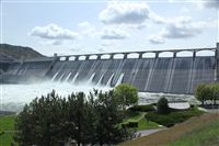
On Saturday we checked out the dam and the Visitors Center there. We found a spot for Oskar to swim and basked in the sunshine. We capped off the day with a short drive back to the dam to watch the laser light show. You should probably see it once but be warned that it’s 40+ minutes long. We were all fighting sleep by the end.
We started off Sunday with a trip back to the dam to take a tour. There are a lot of restrictions post-9/11, but we went down into the third powerplant and they drove us across the top of the dam. I’ll probably make a second post full of the facts we learned on that trip. It’s an incredible piece of construction!
After lunch on Saturday, we headed out on a hike that I picked off the web. At 4 miles and 600 feet of elevation gain, it seemed pretty simple once you got past the “0.15 miles of rock scramble.” Once I saw the hike, I should have turned us around. That first bit was pretty treacherous, often requiring getting down on all fours to make it up the sandy and rocky “path.” Nancy and Logan made it up the first part and then turned around. The rest of us continued on but turned around before making it to the top as we were running out of water and energy. Plus we knew that going down would be even harder than coming up. Unfortunately that was very true.
We had barely started back down the trail when Tyla took a tumble. The squeamish among you should skip this paragraph. She caught her thumb nail on a rock and bent it back about halfway down the nail ripping the nail off the nail bed. Blood ensued as I whipped out my first aid kit and tried to remember the class Tim and I took. I got her bandaged up but then we had to get all the way down the trail and she had lost use of one hand. Thankfully we made it down without any more serious injuries.
Bear Grylls says that a very bad day is a series of small mistakes that you ignore. I was tired of ignoring small mistakes so I decided to put an end to it by taking Tyla to the doctor. If we were at home we might have tried to clean it up ourselves, but we didn’t have many supplies. The only doctor in the small town that was open on Sunday was the ER so that’s where we ended up. They cleaned it out well for her, gave her tips on keeping the pain away, and were very nice in the whole process. Thankfully there was no line so we got through pretty quickly. After hearing what they had to say about it, we probably could have skipped that trip, but I was happy to have finally erred on the side of caution for once and we both felt better knowing that nothing more serious had happened.
So I have to give a huge thanks to the Brandt family for hauling their camper halfway across the state, feeding us, and putting up with my bad choices! If I ever get to pick another campground, I’ll try to find a bigger/quieter one and you can bet that the next hike will be something we can all do without major risk of injury. Thank you all for being so nice about the whole weekend!
This post is already getting pretty long so I’ll save the pictures for another day. However, on the way out there I did mount the Kodak Zx3 to the windshield and make a timelapse video. I wanted to show everyone who quickly the weather and environment can change! In an hour or two, I can drive from wet, cool weather, over a mountain pass through snow and down into a desert complete with tumbleweed!
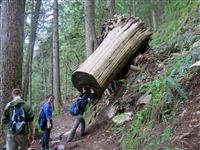
At the end of last week, Tim, Andy, Stephanie, Micah and I cobbled together a plan to go hiking on Saturday. Tim suggested Lake Serene up by his house so we grabbed our gear and set forth. This one is hike #35 in your textbooks.
The day was a bit wet and chilly, but we dressed and packed appropriately. The first mile and a half are a gentile incline up to the base of Bridal Veil Falls. The river comes down over 1000 feet in less than half a mile and the trail snakes right below the last free fall section. Somehow Tucker ended up swimming that pool for a bit, but even the misty spray was enough to suck the heat out of my body.
From there the trail started climbing steeper and it was quite rocky and wet in many spots. There have been a lot of blowdowns and slides along the trail but they were almost all moved out of the way by volunteers. Because of the steepness of the second half of the trail, there are endless switchbacks and stairs built into the hillside. This trail gets a lot of traffic in the summer. If those stairs weren’t there I imagine you’d have a big muddy mess.
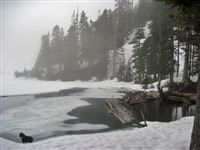
We reached the snow with about half a mile left in the hike. It was 3-4 feet deep in places, but the path was well tracked so we didn’t sink in very far. We arrived at the lake to find it frozen as expected. It will be fun to do this again in the summer and see how different it looks. Mt. Index rises from the opposite side of the lake and adds a very imposing backdrop to the lake.
All in all it’s about 7.5 miles and 2200 feet of elevation gain. Poles aren’t required but were a big help in the muddy and snowy sections. Both hiking books that we looked at rated the difficulty as 3 out of 5.
I didn’t want to risk the nice camera in the heavy mist/rain, but I did bring the little point and shoot to document the trip. Photos are in the gallery tagged with “Lake Serene.”
There won’t be a lot of hikes available for the next couple months as the snow melts so we’re stuck in the lowlands trying to avoid the crowds. A couple weeks ago, Tyla, Micah and I headed out to Squak Mountain. For those of you following along in your textbooks, this is hike #5. The hike winds around the least crowded of the Issaquah Alps and covers a lot of the estate of the founder of the KING broadcasting company. In fact, part of the hike goes right past the foundation of the old house and the large fireplace is still standing. The hike wasn’t that memorable, but it was nice to get out on a beautiful day and stretch the legs a little bit.
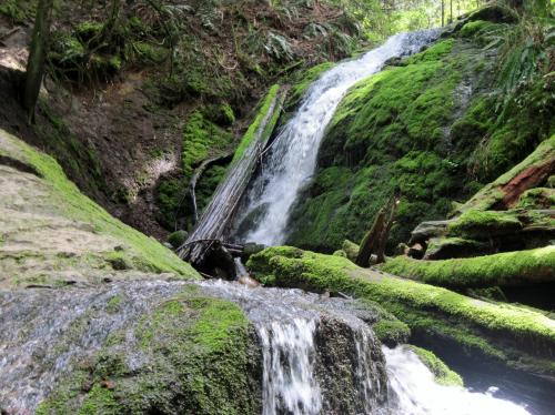
This past weekend, the three of us headed out again to hike along the De Leo Wall on Cougar Mountain. This one is hike #2 in the book and it was a bit more interesting than the previous hike. The trailhead was swamped with people but we left them all behind pretty quickly and found a bit of solitude. We never made it to the viewpoint because of some confusing signage and text in the book, but we did find the waterfall.
All in all these were decent hikes for early in the season but I won’t be itching to do either one again. The Squak Mountain hike was notable for some very bad guidance from the book. It usually does a good job of leading you along the trail, but Squak and Cougar are so riddled with a maze of trails that it can get pretty tricky.
Hopefully we’ll get some warmer weather soon to get that snow melting up in the mountains! There is still 10-20 feet of snow in most places up there.
There is a relatively new (at least to me) website called dailyhiker.com that I’ve been following. The guys who run it are local to the Pacific Northwest but the blog covers hiking around the world. They ran a contest recently for the best lake photo so I submitted my photo of MattM skipping rocks into the Puget Sound (technically not a lake I guess) on last summer’s camping trip. I didn’t win but I did make it into the top 13. Interestingly it’s the only photo in that group that has a person in it. This photo was taken with our little point and shoot. I’m really looking forward to hiking around with the T2i this summer.
 On Memorial Day weekend, Tyla and I headed over to Lake Chelan State Park with her family. It’s on the east side of the mountains, so if you remember your Washington geography, you’ll know that it’s in the desert.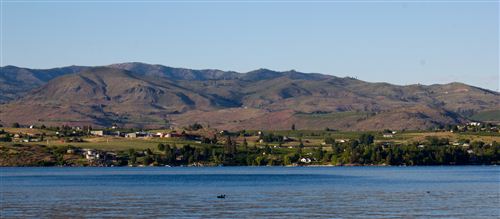
 We gave nephew David a kid sized Camelbak for his 6th birthday, and it reminded me of a post I’ve been meaning to do for a while on how to properly clean a hydration pack. Before I met Tyla, I don’t know if I cleaned mine more than once or twice. Turns out she doesn’t like drinking moldy water. Who knew? We now have quite a few of these bladders and I’ve gotten a lot better at keeping them sanitary.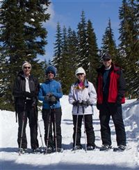
 I headed out with the Brandt family to Alder Lake State Park for the Fourth of July weekend. It wasn’t our first choice since we got a late start on reservations, but the campground actually was pretty nice. The biggest downside was that it was close to Hwy 7 which is the western entrance to Mt. Rainier, but the traffic died down a bit at night and the fan in the camper drowned out the noise.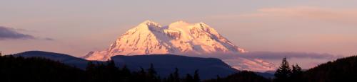
 We have had quite a few new young couples join our church recently, so we decided to put together a camping trip. Unfortunately I picked a weekend when not a lot of the new people could join us, but we still did get a good crew together for a fun weekend.
 It inevitably rains in the Puget Sound area over Memorial Day, so this year we decided to head east of the mountains. For those of you unfamiliar with Washington geography, the Cascade Mountains run down the state and create two very different environments. The west side is dominated by the ocean weather so it’s very mild year round with lots of rain. The east side of the mountains is a certified desert with extreme temperatures. You’re almost guaranteed to get sunshine. So with that knowledge in hand, we looked into a trip to the Grand Coulee Dam.
 At the end of last week, Tim, Andy, Stephanie, Micah and I cobbled together a plan to go hiking on Saturday. Tim suggested Lake Serene up by his house so we grabbed our gear and set forth. This one is hike #35 in your
  We reached the snow with about half a mile left in the hike. It was 3-4 feet deep in places, but the path was well tracked so we didn’t sink in very far. We arrived at the lake to find it frozen as expected. It will be fun to do this again in the summer and see how different it looks. Mt. Index rises from the opposite side of the lake and adds a very imposing backdrop to the lake.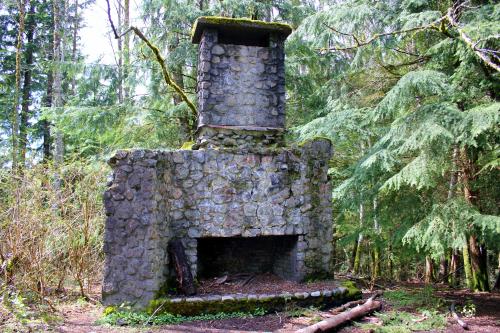
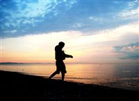 There is a relatively new (at least to me) website called dailyhiker.com that I’ve been following. The guys who run it are local to the Pacific Northwest but the blog covers hiking around the world. They ran a contest recently for the best lake photo so I submitted my photo of MattM skipping rocks into the Puget Sound (technically not a lake I guess) on last summer’s camping trip. I didn’t win but I did make it into the top 13. Interestingly it’s the only photo in that group that has a person in it. This photo was taken with our little point and shoot. I’m really looking forward to hiking around with the T2i this summer.